A806
| A806 | |||||||
| Location Map ( geo) | |||||||
| |||||||
| From: | Kirkintilloch (NS651743) | ||||||
| To: | Stepps (NS668689) | ||||||
| Distance: | 3.9 miles (6.3 km) | ||||||
| Meets: | A803, B757, B8048, B819, B757, M80, A80 | ||||||
| Former Number(s): | A8006, M80 | ||||||
| Highway Authorities | |||||||
| Traditional Counties | |||||||
| Route outline (key) | |||||||
| |||||||
For the former A806 in western Glasgow, see A806 (Canniesburn - Scotstoun).
The current incarnation of the A806 was created in 2010 when the A8006 extension south from Kirkintilloch was completed. It is not entirely clear why there was a need to renumber the route at the same time.
Route

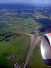
Starting at a signalised T-junction on the A803 Kirkintilloch bypass the road runs south through a cutting and into the town, running along a relief road to the east of the town centre. After crossing over the Forth & Clyde Canal, the road runs past parkland alongside the Luggie Water, which was diverted when the road was built. Mid way past the park, the road picks up the line of the old Strathkelvin Railway before meeting the first of a number of roundabouts on the route, with the B8048. Continuing south through the suburbs, another couple of roundabouts are met, the second with the B819 and the road goes under the Glasgow to Falkirk railway line. Just before the B819 roundabout, the road swings south west, leaving the old trackbed behind and after following a dead-straight route through open country (partly in a cutting), another roundabout leads to the M80 at Hornshill Junction, J3.
Beyond the roundabout, the A806 becomes dual carriageway, using what was for many years the 'temporary' end of the M80. Initially it follows the westbound carriageway, the eastbound side having taken a wider loop. As the road bears round to the right, it picks up the old eastbound carriageway as well and ends soon afterwards at the Crowwood Roundabout on the A80. To emphasise this section of the road's origin as part of the M80, the road gains hard shoulders just before it ends.
History
In December 2010, construction of the 2.5 mile Kirkintilloch Link Road extended the short A8006 and the new route was designated as the A806. Although the new section of road from the B8048 to the M80 was officially opened on the 28th November 2010, it remained closed until the 1st December 2010 due to heavy snowfall repeatedly obscuring road markings and signposts. Contractor was Carillion, contract price £21 million.
Upon completion of the M80 offline upgrade the following year, the route from Hornshill to Crowwood Roundabout at Stepps (which was originally M80) also became part of the A806, giving the road its current route.
Future Developments
The Glasgow Local Plan also includes the Easterhouse Regeneration Route which would continue from the southern end of this route at Crowwood roundabout through to the Glasgow Fort complex at J10 of the M8 - this road may form a further extension of the A806. The route identified in Documents on Glasgow Councils Website shows the Easterhouse Regeneration Route using Dewar Road, which heads south from Crowwood roundabout and currently terminates at a field gate. The route then cuts across the Seven Lochs Wetland Park, keeping west of the small loch on Gartloch Road (B806), before crossing the road and heading south east to meet Westerhouse Road in Easterhouses, which leads directly to the motorway junction.
Links
- Glasgow City Council Proposal Document Easterhouse Regeneration Route is Proposal T005 on page 5


