A806 (Canniesburn - Scotstoun)
| A806 | |||||||
| Location Map ( geo) | |||||||
| |||||||
| From: | Canniesburn Toll (NS547710) | ||||||
| To: | Scotstoun (NS522680) | ||||||
| Via: | Anniesland | ||||||
| Distance: | 3 miles (4.8 km) | ||||||
| Met (1961): | A81, A809, A82, A814 | ||||||
| Now part of: | A739 | ||||||
| Traditional Counties | |||||||
| Route outline (key) | |||||||
| |||||||
For the present A806 to the north of Glasgow, see A806.
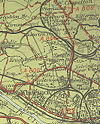
The A806, as originally classified in 1922, ran from Canniesburn Toll to Scotstoun via Anniesland Cross, in the western suburbs of Glasgow. It seems to have acquired a slight dogleg at Anniesland when the A876 (now A82) Great Western Road extension was opened in the late 1920s, although the junction has been rebuilt since, so it is not clear what the precise alignments of the roads was. Certainly the 1923 map shows a sharp bend or even TOTSO at this junction. The majority of the route is S4 or D2 today, and seems to have been designed that way, as the facing properties are Victorian/Edwardian in places. In recent years, some of this formerly wide route has been reduced in width by the construction or lining of parking bays and changes to pavements, reducing the carriageway to S2 or D1. However, the original width is still easy to identify.
The route started at Canniesburn Toll and headed south along Switchback Road, becoming Bearsden Road as it crossed the Glasgow City boundary, and curved right to cross two railway lines and the canal in quick succession. This led to Anniesland Cross, where the route crossed the A82, Great Western Road and, with a slight dogleg, headed west along Anniesland Road. After crossing another railway, the A806 continued along Kingsway, although it appears that this was a new build road and that in 1922 the route continued along Anniesland Road, with the two routes reaching the A814, Dumbarton Road, within a few yards of each other at Scotstoun.
The section between Canniesburn and Anniesland is now part of the A739 which was extended north of the Clyde with the opening of the Clyde Tunnel, whilst the section from Anniesland to Scotstoun (via Anniesland Road and Kingsway) is now unclassified, having been downgraded comparatively recently.


