B8022
| B8022 | ||||
| Location Map ( geo) | ||||
| ||||
| From: | Limerigg (NS857705) | |||
| To: | Babbithill (NS894721) | |||
| Via: | Slamannan | |||
| Distance: | 4.5 miles (7.2 km) | |||
| Meets: | B825, B803, B825 | |||
| Highway Authorities | ||||
| Traditional Counties | ||||
| Route outline (key) | ||||
| ||||
The B8022 is a rather curious road, starting and finishing on the B825 and taking a somewhat circuitous route through Slamannan. The route is 4½ miles long, although from end to end on the B825 is only about half that.
Route
Starting, therefore, in High Limerigg, the road heads north through Low Limerigg, before winding a little to the east through farmland. This is an old mining area, and the houses passed today are simply the remnants of what were once large communities. Many of the old miners cottages have been cleared away, and while some were replaced with more modern properties, many were no longer required as the residents had moved on when the mining industry faltered. Beyond Limerigg, houses continue to be dotted along the roadside, giving a semi-urban feel to the road, which is enhanced as it passes through Binniehill and into Slamannan itself. In the village, the road curves round to the left, into the High Street and becomes the B803. However, the B8022 turns east at a TOTSO onto Avonbridge road before the B803 turns north, also at a TOTSO, onto Main Street, and so it is unclear which number the short link between the junctions carries, although as the B8022 came along later it is the most likely candidate.
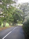
The junction with Avonbridge Road is signed merely to Avonbridge, giving no indication that it is a classified route, but the road remains a decent S2 as it heads east. It is bendier than before, with some sharp right-angle turns as it winds between fields. There are fewer houses too, giving it a much more rural feel as it runs between high hedges with occasional breaks for gates. There is a cluster of houses at Crossburn, but this is the only place even approaching a village on this section of the road. After a few more sharp turns, the road comes to an end at a crossroads at Babbithill, where neither of the road numbers are signed, although this is the B825 once more, with an unclassified road straight ahead.
History
The route was originally unclassified but was initially created before 1927, when it is shown on the revised MOT map. At that time, it was only the western, north-south portion of the route that was given the number, connecting Limerigg and Slamannan. Within a few years, however, it had been extended to the east to its current extent, as is shown on the 1932 Ten Mile Map.
| B8022 | ||
| ||
|

