B8086
| B8086 | ||||
| Location Map ( geo) | ||||
| ||||
| From: | Scalasaig (NR394941) | |||
| To: | Kiloran (NR399973) | |||
| Via: | Kilchattan | |||
| Distance: | 6.9 miles (11.1 km) | |||
| Meets: | B8087, B8085, B8087, unclassified | |||
| Former Number(s): | A870 | |||
| Highway Authorities | ||||
| Traditional Counties | ||||
| Route outline (key) | ||||
| ||||
The B8086 is the longest of the three classified roads on Colonsay.
Route
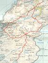
The road starts at the same point as the B8087 in the largest settlement on the island, Scalasaig. The junction is at the top of the road to the Ferry Pier, although curiously that short section of road is unclassified. Even more curious to casual browsers of maps is that the road is shown starting at a roundabout. This isn't strictly speaking correct, although it is a crossroads with a circular grassy traffic island in it, traffic is not directed, nor does it drive around the roundabout island!
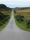
The road starts off, therefore, by heading almost due west through the scattered buildings of Scalasaig to reach the Colonsay Hotel. Here, it winds through the trees a little, before an even longer straight takes it past the B8085 turning for Oronsay. This again is a curiosity on this Hebridean island, as normal procedure is that the lowest numbered road on an island served the ferry port (although subsequent changes to ports have often obscured this point). The road then climbs a little, through a rugged landscape of crags and cliffs rising from peat bog, to cross a low watershed and reach the western side of the island. The sea itself may not be immediately visible, but after a few more twists and turns it is.
The coastline of the island is as rugged as its interior, and the long spits of rock between tiny sandy coves can be seen beyond the golf course. What is less obvious, although far more important to this island community, is Colonsay Airport, opened in 2010, which nestles against the hill at the back of the golf course. A signed turning winds around the greens to reach it. Beyond the golf course, with its honesty box in place of a clubhouse, the road twists and turns again to cross another rocky ridge before dropping down to the shore, and a rocky beach at Kilchattan. At the head of the bay is a tiny building housing the island's heritage centre.
The road then turns eastwards and climbs a little through this scattered settlement of old and new properties, past the island school and church, and on to a summit of nearly 40m above one of three Loch Fadas! This section of the road sees a series of short straights which continue across the summit and down to the second junction with the B8087. This junction forms a triangle of roads around some trees, with the B8086 sitting somewhat further up the slope than the B8087. Just beyond the junction, the road reaches the steading and estate cottages for Colonsay House at Kiloran. A quick left-right takes it around the edge of the estate (one of the entrance driveways continues straight ahead).
The house, an ancient seat for the lairds of the island, can be seen between the trees as the road passes along the west side of its grounds. The road then swings left, and winds down a hill, passing the public entrance for the gardens, before the classified section of the road comes to an end at a sharp left turn. On a road of many curiosities, this is another, as it stops short of anything of any note. Just around the bend, a track leads off to the northern end of the island, and then a car park is reached at the head of Kiloran Bay, a fine sweep of sandy beach. The road continues, however, winding up a steep switchback route to the cottages of Uragaig. Here the tarmac finally comes to an end, roughly a mile from the end of the B8086, making it the longest of the three (or four if the airport road counts) unclassified roads on the island.
History
This route was originally classified in the mid 1920s as the A870. However, along with all of the roads on Colonsay it was downgraded to a B road between 1988 and 1993.
| B8086 | ||||
| ||||
| ||||
| ||||
|


