M4 (Republic of Ireland)
Jump to navigation
Jump to search
| M4 | |||||||||||||||||||||||||||||||||||||||||||||||||||||||||||||
| Location Map ( geo) | |||||||||||||||||||||||||||||||||||||||||||||||||||||||||||||
 | |||||||||||||||||||||||||||||||||||||||||||||||||||||||||||||
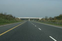
| Heading west on the M4 | |||||||||||||||||||||||||||||||||||||||||||||||||||||||||||||
| |||||||||||||||||||||||||||||||||||||||||||||||||||||||||||||
| From: | Weston, near Leixlip (O013354) | ||||||||||||||||||||||||||||||||||||||||||||||||||||||||||||
| To: | Heathstown, near Kinnegad (N599450) | ||||||||||||||||||||||||||||||||||||||||||||||||||||||||||||
| Distance: | 46 km (28.6 miles) | ||||||||||||||||||||||||||||||||||||||||||||||||||||||||||||
| Meets: | M6, N4 | ||||||||||||||||||||||||||||||||||||||||||||||||||||||||||||
| Highway Authorities | |||||||||||||||||||||||||||||||||||||||||||||||||||||||||||||
| Traditional Counties | |||||||||||||||||||||||||||||||||||||||||||||||||||||||||||||
| Route outline (key) | |||||||||||||||||||||||||||||||||||||||||||||||||||||||||||||
| |||||||||||||||||||||||||||||||||||||||||||||||||||||||||||||
| Junction List | |||||||||||||||||||||||||||||||||||||||||||||||||||||||||||||
| |||||||||||||||||||||||||||||||||||||||||||||||||||||||||||||
This article is about the Republic of Ireland's M4.
For the British road that runs between London and Swansea, see M4.
For the unbuilt Northern Irish road with this number , see M4 (Northern Ireland).
For the British road that runs between London and Swansea, see M4.
For the unbuilt Northern Irish road with this number , see M4 (Northern Ireland).
The M4 is the motorway-standard part of the N4 route from Dublin to Sligo.
Route
The M4 extends from J5 at Weston in County Dublin to J13 at Heathstown in County Westmeath.
History
A motorway replacement for the N4 was first conceived in 1965. This would have started at Leixlip (being the counter border), ran north of Lucan, and met what's now the M50 near Castleknock. The motorway would then have continued into central Dublin by covering the Royal Canal (which wasn't navigable), right the way to North Wall.
This would have been divided into two contracts, named "N4 Motorway" and "Royal Canal Motorway", though they would flow as one road.
- J5-J8 opened in 1994 as the "Leixlip Maynooth Kilcock bypass", albeit numbered as J2-4. What is now J6, numbered then as J2a, opened in 2003.
- J9-12 opened in 2005. This section of road is tolled.
- J12-13 also opened in 2005 but as D2AP. It was redesignated as motorway in 2009.
- Enfield Services opened in 2010
Links
Irish Statute Book
- Roads Act 2007 (Declaration of Motorways) Order 2009 - This instrument converts the following sections of the N4 to motorway: Kinnegad to McNead’s Bridge
RTÉ
- Kilcock bypass controversy (1986)
- Motorway Into The West (2005)
Mótarbhealaí
Engineers Ireland
| M4 (Republic of Ireland) | ||||||||
| ||||||||
| ||||||||
| ||||||||
| ||||||||
| ||||||||
|


