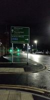
A5196
| A5196 | |||
| Location Map ( geo) | |||
 | |||
| |||
| Centre Park Link Road | |||
| From: | Wilson Patten Street (SJ600878) | ||
| To: | Chester Road (SJ602865) | ||
| Via: | Slutchers Lane | ||
| Distance: | 1.5 km (0.9 miles) | ||
| Meets: | A5060 • A5061 | ||
| Highway Authorities | |||
| Traditional Counties | |||
The A5196 is a new road that opened in 2021 that appears on recent OS maps but the rest of the world hasn't yet caught up. This forms a new bypass of Warrington Town Centre particularly the gridlock that is Bridgefoot where the A49 joins the A5061 basically bringing anyone that is trying to get across Warrington together in one roundabout.
The road is partly new build at its southern end, but the northern part is old road which used to link various industrial zones to the rest of the road network. It starts on the A5061 at Wilson Patten Street, opposite the (old) police station and adjacent to Bank Quay station and heads over the old low level railway line and past various industrial units in a southerly direction. There's not much to look at as we are hemmed in by the buildings. After about half a mile, the industrial units stop and the old tarmac gives way to much newer surface as we reach the new section that used to be a golf driving range. Now the road swings east over the River Mersey and soon arrives at its southern terminus with the A5060 Chester Road.
Links
- Centre Park Link - Full Business Case January 2020 (archive.org)

