A5061
| A5061 | |||||||
| Location Map ( geo) | |||||||
| |||||||
| From: | Westy (SJ595881) | ||||||
| To: | Sankey Bridges (SJ627871) | ||||||
| Via: | Latchford | ||||||
| Distance: | 2.3 miles (3.7 km) | ||||||
| Meets: | A50, A49, A57, A5196 | ||||||
| Former Number(s): | A50, A57 | ||||||
| Old route now: | A49 | ||||||
| Primary Destinations | |||||||
| Highway Authorities | |||||||
| Traditional Counties | |||||||
| Route outline (key) | |||||||
| |||||||
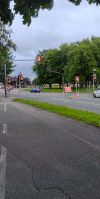
The A5061 runs roughly east-west across Warrington, providing a link into the town centre from both directions.
Route
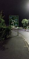
It starts on the A50 just north of the Manchester Ship Canal at a strange multiple gyratory around Latchford Village and heads West. It passes to the south of Victoria Park before reaching the River Mersey, which it follows into the town centre. It crosses the river and the A49 at the same time over Bridgefoot.
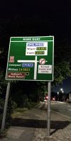
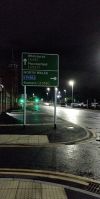
The road then skirts the southern edge of the town centre alongside the two railway lines which cross at Bank Quay station. It meets the original line of the A57 at traffic lights; at one time the road ended here but now it TOTSOs left to cross the West Coast Main Line and end at the Sankey Green signalised roundabout on the present A57.
History
The original line of the A5061 ran along Mersey Street in Warrington town centre between the A49 Bridge Street and A57 Buttermarket Street. What is now the A5061 east of the A49 was the original northern end of the A50.
In 1935 the A50 was given a spur around the eastern side of Warrington; this is now its current route but the old route into town remained the A50 at least until the 1950s. Later the original route of the A49 through town was declassified and the road diverted along Mersey Street, taking over the full original length of the A5061. The number was transferred to the old A50 plus its western extension. It is not known whether any part of the current A5061 has continuity with the original route. What is known is that the A50 originally ended on the A49; the road to the west was originally unclassified but later gained Class I status so this could have been the A50 or A5061 amongst other suggestions.


