Star.pngStar.pngStar grey.pngStar grey.pngStar grey.png

A5102

From Roader's Digest: The SABRE Wiki
Jump to navigation Jump to search
A5102
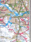
Location Map ( geo)
Cameraicon.png View gallery (6)
From:  Wilmslow (SJ858804)
To:  Stockport (SJ899890)
Via:  Bramhall
Distance:  7.1 miles (11.4 km)
Meets:  A538, B5358, A5149, A555, A5149, A5143, A6
Former Number(s):  B5092, B5093
Primary Destinations
Highway Authorities

Cheshire East • Stockport

Traditional Counties

Cheshire

Route outline (key)
A5102 Wilmslow - Stockport

The A5102 is a semi-urban road to the south of Stockport. Originally numbered B5092 and B5093, it gained its current number around 1930.

Route

Wilmslow Road, near Woodford

It starts at a roundabout on the A538 to the east of Wilmslow and heads north over the River Bollon then east along Adlington Road to reach Dean Row. There by the use of adjacent roundabouts the B5358 is crossed.

The A5102 enters Stockport Metropolitan Borough, although we're not particularly metropolitan to begin with. We soon reach Woodford, whose aerodrome used to be the home of British Aerospace but this is now closed. We reach a roundabout where the A5149 goes straight on and the A5102 turns left along Woodford Road as the dominant number in a multiplex with the A5149 and reach the eastern terminus of the A555 at its terminus, which currently is rather optimistically signposted to Manchester Airport.

The A5102 continues into Bramhall, a busy Stockport suburb. The multiplex ends here at a mini-roundabout, where we bear right to continue along Bramhall Lane South under a railway bridge by the station. We continue to reach Bramall roundabout (spelt without the H) where we meet the A5143 and pass the grounds of the imposing Bramall Hall.

The road continues over the old Midland Railway line from London St Pancras to Manchester Central, now a freight line, and goes through the suburb of Davenport, where it passes the station. The road ends at traffic lights on the A6 to the south of Stockport town centre.


A5102
Junctions
Places
Related Pictures
View gallery (6)
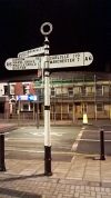
Wilmslow Road - Geograph - 130702.jpgUnknown motorway south of Cheadle - Coppermine - 14901.jpg20180206-2259 - Carlisle 119 fingerpost, Stockport.jpg20181220-1203 - Woodford Road Junction 53.350102N -2.167153W.jpg20181220-1203 - Woodford Road Junction 1 - 53.350064N 2.164557W.jpg
Other nearby roads
Wilmslow
A34 • A34(M) • A526 (Newcastle-under-Lyme - Salford) • A538 • B5085 • B5086 • B5092 • B5166 • B5358 • B5359
Stockport
NCN55 • A6 • A6(M) (Bredbury - Hazel Grove) • A6(M) (Heaton Norris - Hazel Grove) • A34 • A523 • A555 • A560 • A626 • A627 • A5035 (Stockport) • A5143 • A5145 • A5149 • A6017 • A6180 • A6188 • B5093 (Cheshire) • B5094 • B5095 • B5169 • B5423 • B5465 • B6101 • B6102 • B6103 • B6104 • B6167 • B6168 (Stockport) • B6171 • B6184 • C453 (Stockport) • C462 (Stockport) • M56 • M60 • M63 • M66 • M68 • T12 (Britain) • T55 (Britain) • T59 (Britain)
A5100-A5199
A5100 • A5101 • A5102 • A5103 • A5104 • A5105 • A5106 • A5107 • A5108 • A5109 • A5110 • A5111 • A5112 • A5113 • A5114 • A5115 • A5116 • A5117 • A5118 • A5119
A5120 • A5121 • A5122 • A5123 • A5124 • A5125 • A5126 • A5127 • A5128 • A5129 • A5130 • A5131 • A5132 • A5133 • A5134 • A5135 • A5136 • A5137 • A5138 • A5139
A5140 • A5141 • A5142 • A5143 • A5144 • A5145 • A5146 • A5147 • A5148 • A5149 • A5150 • A5151 • A5152(W) • A5152(E) • A5153 • A5154 • A5155 • A5156 • A5157 • A5158 • A5159
A5160 • A5161 • A5162 • A5163 • A5164 • A5165 • A5166 • A5167 • A5168 • A5169 • A5170 • A5171 • A5172 • A5173 • A5174 • A5175 • A5176 • A5177 • A5178 • A5179
A5180 • A5181 • A5182 • A5183 • A5184 • A5185 • A5186 • A5187 • A5188 • A5189 • A5190 • A5191 • A5192 • A5193 • A5194 • A5195 • A5196 • A5197 • A5198 • A5199
Former uses: A5104 • A5112 • A5125

SABRE - The Society for All British and Irish Road Enthusiasts
Discuss - Digest - Discover - Help