Star.pngStar.pngStar grey.pngStar grey.pngStar grey.png

A524 (Fenny Bentley - Rowsley)

From Roader's Digest: The SABRE Wiki
Jump to navigation Jump to search
A524
Location Map ( geo)
Cameraicon.png View gallery (5)
From:  Fenny Bentley (SK239658)
To:  Great Rowsley (SK176499)
Via:  Youlgreave
Distance:  13.5 miles (21.7 km)
Met:  A515, A5012, A6
Former Number(s):  B5056
Now part of:  B5056
Traditional Counties

Derbyshire

Route outline (key)
A524 Fenny Bentley - Great Rowsley
A524 Newhaven - Great Rowsley
This article is about the original A524 in the Peak District.
For a later incarnation of the A524 between Newcastle-under-Lyme and Ashbourne that may never have actually existed, see A524 (Ashbourne - Stoke-on-Trent)
.


The meeting point of the ex-A524 and B5056

The A524 was a reasonably short A-road in west Derbyshire.

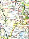
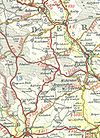
As originally classified in 1922, the road started Fenny Bentley on the A515 north of Ashbourne. The road ran northeastwards, bypassing all the villages until it crossed the B5055 (A5012 after 1935) at Grangemill. The road now headed north. It passes between Elton and Winster before crossing the River Lathkill and following it to the River Wye. The A524 ended here on the A6, between Haddon Hall and Rowsley.

Around 1970 the number was swapped with that of the B5056, being the road from Newhaven (further north along the A515), via Youlgreave, to the same point on the A6. The section east of the bridge across the River Lathkill remained constant in this change.

By 1976, however, the rerouted A524 from Newhaven to the A6 had been declassified, leaving the B5056 to be extended to the A6 and so giving the current B5056 the same route as the original A524.

Steve Jukes writes:
In 1968, the A524 route ran as in 1922: Fenny Bentley -> Grangemill -> Rowsley. In 1977, the A524 route ran as: Newhaven -> Youlgreave -> Rowsley. In both cases, the B5056 is the "opposite" route. By 1983, the A524 had become declassified, whilst the B5056 has continued, alive and well!
Andie(Coasterjunkie) writes:
I'm surprised that an A-road was ever given this alignment! The road through Youlgreave is extremely narrow, with people's front doors opening right onto the street - the same goes for the shops and pubs too. There is also a kink in the road at a crossroads that is awfully tight. What mystifies me is why the routing was changed between 1971 and 1974. There are numerous limestone and other aggregate quarries in that part of the Peak District, so perhaps there was a need at that time for an A-road to follow that alignment - maybe to stop heavy traffic from getting stuck on really narrow roads and that the route through Youlgreave was the best of a poor set of options.
Simon Mold writes:
A few more thoughts (just to muddy the waters). What is now the B5056 is indeed a narrow, twisty affair, which has always been signed to Bakewell. Thus originally Ashbourne-Bakewell was an A road (i.e. between two towns). Youlgreave (pronounced Yoolgrave, btw) was signed from Newhaven, and I think did become the A524 on account of the increased quarry traffic - or, slightly oddly, because there are some significant quarries on the current B5056 which the authorities wanted non-quarry traffic to avoid. Get stuck behind a quarry truck on this road and you do go rather slowly!

Round about 1970 several A roads in the Peak District were downgraded - these included the A622, A6010, A6011, A623... and the A524, which of course vanished altogether. The Peak Park Planning Board wanted to funnel traffic onto strategic routes (called "Routes for People"); this scheme also resulted in the odd upgrade, viz the A6020 and the new A5270. This aimed to discourage traffic from ratrunning through villages and upsetting herds of cows, etc.

The B5056 is a "real" B road, and traffic on it is light. I guess its current status reflects its actual use rather than its 1922 imagined use. If the A524 were to be reinstated, then maybe Ashbourne-Wirksworth (for Matlock) would be more sensible: the current B5035 is wide enough and quite heavily used.

Incidentally, the old termination of the A524 with the A6 is called Pickery Corner (slightly more precise then "near Rowsley"). (3 Miles from one's childhood home, etc, etc).

Original Author(s): Lez Watson


A524 (Fenny Bentley - Rowsley)
Related Pictures
View gallery (5)
A524-1924.jpgA524 (2004) - Coppermine - 442.jpgA524 (1977) - Coppermine - 441.jpgA524 (1968) - Coppermine - 440.jpgJunction of the B5056 and Alport Lane - Geograph - 1241597.jpg
A500-A599
A500 • A501 • A502 • A503 • A504 • A505 • A506 • A507 • A508 • A509 • A510 • A511 • A512 • A513 • A514 • A515 • A516 • A517 • A518 • A519
A520 • A521 • A522 • A523 • A524 • A525 • A526 • A527 • A528 • A529 • A530 • A531 • A532 • A533 • A534 • A535 • A536 • A537 • A538 • A539
A540 • A541 • A542 • A543 • A544 • A545 • A546 • A547 • A548 • A549 • A550 • A551 • A552 • A553 • A554 • A555 • A556 • A557 • A558 • A559
A560 • A561 • A562 • A563 • A564 • A565 • A566 • A567 • A568 • A569 • A570 • A571 • A572 • A573 • A574 • A575 • A576 • A577 • A578 • A579
A580 • A581 • A582 • A583 • A584 • A585 • A586 • A587 • A588 • A589 • A590 • A591 • A592 • A593 • A594(N) • A594(S) • A595 • A596 • A597 • A598 • A599
Defunct Itineraries & Motorways : A500 • A506 • A511(N) • A511(S) • A524 • A526 • A529 • A544 • A555(N) • A555(S) • A556(M) • A563 • A564 • A569 • A580 • A598


SABRE - The Society for All British and Irish Road Enthusiasts
Discuss - Digest - Discover - Help