A521
| A521 | |||||||||||||
| Location Map ( geo) | |||||||||||||
| |||||||||||||
| From: | Meir Park (SJ943416) | ||||||||||||
| To: | Froghall (SK022471) | ||||||||||||
| Via: | Cheadle | ||||||||||||
| Distance: | 8.3 miles (13.4 km) | ||||||||||||
| Meets: | A50, B5029, A522, A52 | ||||||||||||
| Former Number(s): | A50 | ||||||||||||
| Old route now: | A522 | ||||||||||||
| Highway Authorities | |||||||||||||
| Traditional Counties | |||||||||||||
| Route outline (key) | |||||||||||||
| |||||||||||||
The A521 is a relatively short length of non-primary road linking the A50 and the A52 east of Stoke-on-Trent.
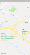
The route starts at a grade-separated junction with the A50 at Meir Park just outside the Stoke-on-Trent City Council boundary, though it is within the urban area. It originally began in the middle of the village of Blythe Bridge, but now begins at the western end of the A50 Blythe Bridge bypass. It follows the course of the old A50 through the village, crossing the Stoke-Derby railway line by means of a level crossing just after it meets the B5029.
In the centre of Blythe Bridge the A521 turns north at a poorly signed junction, although a spur continues straight on to meet the A50 at the eastern end of the bypass. However, owing to the central reservation, eastbound traffic has to turn left onto the unclassified road and so cannot actually reach the A50. Uttoxeter-bound traffic is therefore signposted via the B5039 instead.
Returning to the original southern terminus of the A521, we head north, passing through the villages of Forsbrook (now a suburb of Blythe Bridge) and Boundary, before descending to the market town of Cheadle.
Originally the A521 went along Cheadle's High Street. Now a one-way system is in operation where eastbound traffic still uses the High Street, before reaching the A522 at a mini-roundabout. Westbound traffic leaves the A522 at a full-size roundabout to the south and is routed along back streets, affording a good view of "Pugin's Gem" (the Catholic Church, whose spire is visible for miles) before rejoining eastbound traffic by the Anglican Church.
Leading out of Cheadle, the A521 multiplexes with the A522 for a few hundred yards (although originally the A521 was the dominant partner), before turning right and regaining its number. It reaches the linear village of Kingsley Holt, which stretches for some distance along the A521. After leaving the village, the road descends quite steeply into the Churnet Valley and the village of Froghall. The A52 comes down from the left to meet the A521 and the two roads meet at a very sharp junction meaning that turning left is very difficult.


