A556
| A556 | ||||
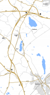
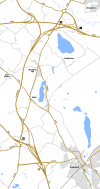
| Location Map ( geo) | ||||
| ||||
| From: | Delamere (SJ545685) | |||
| To: | Bowdon (SJ743858) | |||
| Distance: | 18.7 miles (30.1 km) | |||
| Meets: | A54, A49, A559, A533, A530, A559, A5033, M6, A50, A5034, M56, A56 | |||
| Old route now: | A559 | |||
| Primary Destinations | ||||
| Highway Authorities | ||||
National Highways • Cheshire East • Cheshire West and Chester | ||||
| Traditional Counties | ||||
| Route outline (key) | ||||
| ||||
Route
The A556 is a truly excellent stretch of road in most sections, but by having had no development for 30 years, is now totally inadequate for the traffic it conveys, especially at peak periods. Part of the main Manchester-Chester/N Wales trunk road (A56/A556/A54/A51), the road has now been partly relieved by the M56. Contrary to what might appear from an atlas, the M56's primary purpose is to relieve this road, not the A56 which runs parallel to it (I call the A556/A54/A51 the "A303 of the north" as it does unto the A56 what the A303 does to the A30). The main problem is that the M56 lies too far north to cater for traffic to Manchester originating in Northwich and Winsford, and the huge and very affluent rural population of the surrounding north Cheshire countryside, all wishing to access Manchester for work purposes.
The full length of the A556 became part of the Swansea-Manchester trunk road in 1936. The only section to remain trunk today is the 4 miles between the M56 and M6.
Section 1: Delamere – Over Tabley
You can tell how important it is by the very high standards of it in places, with a considerable percentage consisting of four-lane single carriageway, with a reasonably good dualled section (Northwich bypass) in the middle, albeit interdicted with busy roundabouts and traffic light junctions where other busy roads join it, (Lostock Gralam A559 , and Smoker Hill, (unclassified)). Out of peak hours, it can be a very fast road, and it is easy to do a good 70 plus along the D2 sections and 60 mph on the S2 and S4 sections, whilst keeping a watchful eye out for GATSOs and radar traps.
Starting on the edge of Delamere Forest (one of a number of wooded areas around here) where the A54 TOTSOs, the A556 skirts the village of Delamere before crossing the A49 at traffic lights on the edge of Sandiway. The road becomes D2 before leaving the village behind and to begin with has quite obviously been upgraded by adding a westbound carriageway to the existing road. Recent speed management actions by Cheshire councils have resulted in many NSL sections being reduced to 50 or even 40 mph., and speed cameras now proliferate.
A simple GSJ is soon met on the edge of Hartford and the A556 bears right onto the Northwich bypass. The road turning off here, the A559, is the pre-bypass route of the A556. The road goes over the West Coast Main Line before we find out that the bypass is not quite of the status we thought: there is a set of traffic lights at a minor road into Hartford just before we plunge down and fairly sharply to the right to cross the River Weaver. Here the road is on the 1938 alignment so clearly designed for the lower speeds of pre-war traffic. After the river bridge, the road rises, and bends sharply left; there is a LILO junction westbound to access Davenham. Just afterwards, a residential road (with gap in the central reservation to serve it) turns off left; this is part of the Northwich suburb of Kingsmead but for some reason is not connected to the rest of the town's road network.
A roundabout is then met which forms most of a GSJ with the A533 (the westbound offslip is slightly further east), after which we cross the River Dane, meet a couple of unclassified roads, go over the Trent & Mersey Canal and reach another roundabout on the A530. The B5082 turns off to the right just afterwards, then we meet another unclassified road before going over the Chester to Altrincham railway line to reach a signalised roundabout at the far end of the Northwich bypass where we meet the A559 again.
Back to 4-lane single-carriageway again, the road continues northeastwards. At The Smoker public house at Smoker Hill we pass a complicated signalised junction, (those turning right wait in a special lane to the left) where a minor road gives on to the main road. After this we pass Tabley Old Hall and a cuckoo-clock museum before the A5033 to Knutsford turns off to the right at traffic lights. M6 J19now signalised, is reached soon afterwards.
Original Author(s): Bob Sykes
Section 2: Over Tabley – Bowdon
As of 2017, this section has changed considerably. It still doubles-up as a major route between Birmingham and Manchester, cutting the corner between the M6 and the M56. However, it is now a fast dual carriageway, flowing straight on to the M56 at the northern end.
The new road was a mostly-offline improvement, dubbed an "environmental improvement" as it ended the old road's terrible slog along its ancient path. It isn't quite the A556(M) which the plan replaced, it has a 60mph speed limit to placate environmental concerns and the junction with the M6 remains unimproved (being assigned to a different upgrade package which has encountered many delays). However, it has a smooth surface and a smooth flow, meaning it's a lot better than what was there before.
It opened on 6 March 2017. Contractor was Costain, cost £192 million.
History
Bowdon junction
Before the M56 was built the A56/A556 junction at Bowdon was a "tangent-about": like a conventional roundabout except with reverse priority where Manchester-Northwich traffic joined it. Such traffic had a straight run through without having to give way to anything.
Over Tabley to Bowdon
Until 2017, the section between the M6 and M56 stood out as being much worse than the rest. The A556 still forms part of the signed and official link between Birmingham and Manchester – many readers probably don't realise that until recently to go between two of our most important cities you have to leave the motorway network for a nostalgic crawl along an overloaded A-road – there is no direct access from the M6 onto the M56 east at junction 20. The reason for this was that a proper motorway link between the M6 and M56 was always planned, but just never surfaced. It did look set to happen, as the A556(M), but that was put on hold in the last roads review.
The road was mostly S4 with a 50 mph limit, with traffic lights at Mere on the A50, where only left turns were allowed, and at Bucklow Hill on the A5034, which catered for those prohibited turns. The road dualled again just before going over the M56; the single slip road forming J8 is accessible from the westbound A556 here. The road ended at the A56 on the part-signalised Bowdon Roundabout, which forms J7 of the motorway.
Northwich bypass
The central section of the Northwich bypass, from the A530 to School Lane, just west of the River Weaver, was built in 1939, to judge from the date on the Weaver bridge. According to a parliamentary answer in February 1959, the western section was opened on 15 Dec 1958, the eastern section was expected to be completed about May 1960, and the dualling immediately west of the bypass about April 1960.
Links
legislation.gov.uk
- The A556 Trunk Road in Cheshire (A556/A54 Junction to M6 Motorway) (Detrunking) Order 2001 - This order detrunks a section of the A556 to the west of the M6 following the 1998 review A New Deal for Trunk Roads in England


