1922 Road Lists
| 1922 Road Lists | ||
 | ||
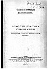
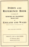
| The Front Cover of the 1922 Road Numbering list. | ||
| Pictures related to 1922 Road Lists View gallery (5) | ||
| Quick Links | ||
| Classification | ||
This portal deals with the schemes of road classification and numbering first drawn up and put into effect in the United Kingdom of Great Britain and Northern Ireland in 1922-23.
Details of the scheme for Great Britain were first made available to the general public in a list of road classifications and numbers issued in booklet form by the Ministry of Transport on 1 April 1923, while those provided for under the (separate) scheme for Northern Ireland were announced in the Belfast Gazette of 14 and 21 December 1923. Both of these schemes were drawn up as a result of powers conferred by Section 17 (2) of the Ministry of Transport Act 1919 – which, in the case of Ireland, were devolved by the Government of Ireland Act 1920 to the respective Ministries of Home Affairs in Belfast and Dublin.
In the short-lived Southern Ireland (which was to become Saorstát Éireann / the Irish Free State on 6 December 1922), responsibility for administering the 1919 Act in matters pertaining to roads was taken over by the Ministry of Local Government on 4 October 1922. Details of the scheme of road classification and the numbers first used in the Free State are not, as yet, to hand.
Great Britain
The scheme of classification of roads in Great Britain (England, Scotland, and Wales) was first published on 1 April 1923. The information we show here is derived from List of class I and class II roads and numbers, a booklet published by HMSO in 1923, and from the Ordnance Survey's half-inch MoT maps.
Preparatory work
This had started in 1914 when the Road Board requested information from the Highway Authorities to enable the classification of roads. Some counties had completed this before it was put on hold during the war years.
The Ministry of Transport Act 1919 gave the Ministry power, subject to the approval of the Treasury, to make advances out of national funds to any authority, Company or person, either by grant or loan, for the following purposes: Construction, improvement and maintenance of railways, light railways and tramways; roads, bridges or ferries. For the roads part it needed classification to determine funding.
The Ministry of Transport sent a circular letter to Highway Authorities in early 1920 inviting their assistance in connection with the new scheme of classification of roads and stating that proposals by any Highways Authority would be taken into consideration in settling the classification. It was put forward that if conferences of representatives of several Highway Authorities within the administrative counties were to be arranged then the proposals of the Authorities could be co-ordinated before the council submitted their classification proposals to the Ministry. The Ministry was then to select points at which they required a census before determining classification. The census costs were borne by the councils.
The main principal laid down by Ministry was the degree of through traffic on a road. This had to be a substantial proportion of the total for it to be classified as either first or second class. The initial grants were set at up to 50% for class I and up to 25% for class II.
The list
The list was first published on 1 April 1923 at a price of 9d (about £1.50 adjusted for 2010). Classification of roads had begun in earnest in 1921, with the A1-A99 being in place by the spring of 1922. Three digit A roads were in place by June, while the remaining A and B roads were completed by February 1923.
During the 1920s, road classifications were regularly updated every 1st April - most frequently this was upgrading B roads to A roads, or unclassified roads to B roads. There was also an "emergency" renumbering in July 1924 after heavy petitioning that rerouted the A1 from Boroughbridge to Darlington via Scotch Corner and caused the A1079 to be created. Consequently, after the annual revision in 1925, the 1922/23 list was considered to be misleadingly out of date and withdrawn from sale.
In its place, the MoT proposed to publish a 1925/26 version of the list the following April. However, it was reported that of the initial 5,000 print run of the 1922/23 list, 3,073 were returned as unsold. Consequently, the republishing was abandoned and no official list of roads was ever sold to the public again.
The maps
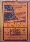
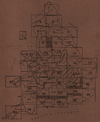
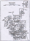
The Ordnance Survey published half-inch maps on behalf of the MoT showing each road number. These were republished annually to tie in with the revisions in April. The sale of these were more successful than the lists; however, after 1932 the publishing of MoT maps became more sporadic.
After the major renumbering exercise on 1st April, 1935, the publishing of MoT maps began to be wound down. In its place, road numbers started appearing on the Ordnance Survey New Popular Edition maps in the 1940s and beyond.
Although some earlier maps from Michelin and Bartholomew were published before 1st April, 1923, they were based on earlier drafts of the numbering scheme that were "leaked" from the MoT, and which were not officially agreed. (For instance, the routes of the A2 and A4 both had alterations between the draft and final listings).
The full set of the 1922-23 OS Ministry of Transport Road Maps are available on SABRE Maps, as well as large numbers of the later editions.
The rules
The original system was more concerned about classifying and identifying a road for funding and maintenance purposes rather than any means of navigation, and had quite strict and systematic rules about what numbers should be allocated where.
- All roads were numbered according to the most anticlockwise zone they ran in. (This was so rigidly enforced that the MoT refused the Scottish MoT's request to allocate the A72 out of zone towards the A68, for example.)
- With a handful of exceptions (due to last minute changes from draft allocations), road numbers were all allocated in increasing order away from London or Edinburgh. (In the case of English 'B' roads, the Bx000 was not far away from the Bx89.)
- While space had been left for future 3 digit 'B' roads, all new classifications (such as upgrading a 'B' road to an 'A' road) were allocated the next available number, with only a handful of exceptions (such as the rerouting of the A1 via Scotch Corner in 1924, or the swapping of the A303 and A3036 in 1933) until 1935.
- Multiplexes were only allowed in a few cases, generally when both roads were long distance routes that intersected for less than two miles.
- What we now know as spurs did not exist prior to 1935 - a road ran on one continuous line and any ambiguous deviation from this required a different number for one of the possible routes. Consequently numerous four-digit A and B roads listed are described as "Link in 'x'" or "Loop in 'x'" and may have been all of a few hundred yards long.
Northern Ireland
Northern Ireland's road lists were first published in December 1923, over two weeks, in the Belfast Gazette. They were arranged by local authority, with the six county councils and the County Borough of Londonderry publishing a week before the County Borough of Belfast.
Republic of Ireland
Planning of the original Trunk and Link road classification system (which remained in place in Ireland until 1977) was started in 1919, before partition, but records of the first classifications and numberings have yet to be discovered. The Local Government Act of 1925 talks about "main roads, county roads and urban roads", whilst in 1926 the Road Signs and Traffic Regulations (SI No 55/1926) make mention of the classification of certain roads as Trunk and Link roads and require the inclusion on directional signs of "the route letter and number" of such roads. T and L roads certainly appear thus labelled on OSNI Road Maps of the mid-1930s, where the sheet extends beyond Northern Ireland.
Isle of Man
On the Isle of Man, the roads appear to have been first classified at some point before February 1926, and appear on Michelin mapping in the late 1920s. The initial batch of numbering appears to have been A1 to A10, as well as B1 to B26, with a number of additions to both classes before 1937. The whole system on the island appears to have been thoroughly re-considered at some point before 1963, with only the A1-A12 retaining their original numbers.
The numbers
- Class I
- Class II
Route Maps
Many thanks to Jonathan Winkler, James Bufford and Brian Swann for helping us obtain and research these lists.

