A4096
| A4096 | ||||
| Location Map ( geo) | ||||
| ||||
| From: | Stonehouse (SO809048) | |||
| To: | Claypits (SO763061) | |||
| Distance: | 3.5 miles (5.6 km) | |||
| Met: | A419, A38 | |||
| Former Number(s): | B4070 | |||
| Now part of: | A419 | |||
| Traditional Counties | ||||
| Route outline (key) | ||||
| ||||
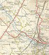
The A4096 was a link road in central Gloucestershire, renumbered from the B4070 in the mid-1920s, which used to run from Stonehouse near Stroud west to the A38 between Cambridge and Whitminster.
From Stonehouse, the A419 originally ran northwards towards Gloucester along what is now the B4008, meeting the A38 at Hardwicke, and so the route heading westwards was designated the A4096. When the M5 was opened in 1971, it was decided to create a new route to Stroud from the motorway and so J13 was built near Whitminster and new link roads were built, westwards to meet the A38 just south of Whitminster and eastwards to meet the A4096 just north of Eastington. The whole route from the A38 to Stonehouse was then reclassified as the A419, with the original route being reclassified as the B4008. The rest of the A4096 through Eastington was declassified and the A4096 road number lost.
The A4096 started near Ryeford, where the A419 took a right-hand turn into Stonehouse. The road then crossed over the Midland Railway's Stroud branch and then under the Midland Railway mainline from Bristol to Gloucester. Following the course of the Stroudwater Canal, the road carried on westwards until at a place called Chipmans Platt, the road turned left and crossed over the canal and River Frome to enter the village of Eastington. In the centre of the village the road then turned right again and headed out to join the A38 at Claypits. This zigzag through Eastington was the section of road replaced by the M5 J13 link roads.


