A251
| A251 | |||||||
| Location Map ( geo) | |||||||
| |||||||
| From: | Ashford (TR006442) | ||||||
| To: | Faversham (TR015607) | ||||||
| Distance: | 11.6 miles (18.7 km) | ||||||
| Meets: | A20, M20, A2042, A252, M2, A2 | ||||||
| Old route now: | A2042 | ||||||
| Primary Destinations | |||||||
| Highway Authorities | |||||||
| Traditional Counties | |||||||
| Route outline (key) | |||||||
| |||||||
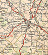
The A251 is a local road in mid Kent that links Ashford to Faversham. It's also useful for Ashford traffic going to Whitstable and Herne Bay, avoiding the A28 which goes through the middle of Canterbury. It's non-primary for its entire length.
Route
The A251 begins at junction 9 of the M20, where it also meets the A20. It passes Ashford's cinema (reputedly the largest in Kent) with all its associated fast food outlets and continues past modern offices surrounded by large grass verges. The roundabouts prevent this from really feeling like a bypass and soon we are running through one of Ashford's plethora of modern housing estates. It is at Goat Lees that we TOTSO left onto the original A251 (the bit down to the A28 is now part of the A2042).
Things are much more rural from the impressive gate to Eastwell Manor onwards. The wall along the left hand side of the road for the next few miles is the boundary of the manor's estate. The A251 is now rural and passes through the picturesque village of Boughton Aluph with its triangular green, before climbing steeply up the North Downs escarpment. The road is now forested until the roundabout with the A252 at Challock.
Continuing on, the road is narrower and less scenic. It passes through Baddlesmere before bending sharply to the right towards Sheldwich. The A251 runs through the scattered village, then on to North Street, where the road suddenly widens and makes a very brief attempt at dual carriageway to cross the M2 at J6. Past this, the road becomes urban in nature, and it passes Faversham Fire Station, before ending at a T-junction with the A2.
History
The A251 originally ran from the A28 north of Ashford up to Eastwell. It was diverted onto its current route to meet the M20 around 2002. Some maps claim that the road between the M20 and A28 is also part of the A251 but it has in fact been the A20 since its opening in 1981.
A few local signs around Faversham claim that the B2041 from The Mall to the station may be part of the A251, but this is not corroborated by any maps or other evidence.


