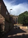
Lichfield
| Lichfield | |||
| Location Map ( geo) | |||
 | |||
| Lichfield Cathedral | |||
| |||
| County | |||
| Staffordshire | |||
| Highway Authority | |||
| Staffordshire | |||
| Forward Destination on | |||
| A38, A51, A515, A5148, A5192, (A446) | |||
| Next Primary Destinations | |||
| Ashbourne • Birmingham • Brownhills • Burton upon Trent • Rugeley • Tamworth | |||
| Places related to the A38 | |||
Bristol • Plymouth • Bodmin • Liskeard • Worcester • Birmingham • Derby • Bromsgrove • Taunton • Exeter • Bridgwater • Burton upon Trent • Gloucester • Mansfield • Droitwich Spa • Ripley • Alfreton • Wellington (Somerset) • Tewkesbury • Saltash • Torpoint | |||
| Places related to the A51 | |||
| Places related to the A515 | |||
Lichfield is a cathedral city in Staffordshire. It is situated close to the centre of the UK road network, some 22 km north-northeast of Birmingham. The Roman roads known as Watling Street and Icknield Street – roughly corresponding to the modern A5 and A38 – crossed at Letocetum (Wall) just over 3 km southwest of the city. Today Lichfield is also close to the M6 Toll motorway, accessed by junctions at Weeford (T4) and Wall Island (T5).
Routes
| Route | To | Notes |
| Burton upon Trent | Accessed via A5127 | |
| Birmingham | ||
| Tamworth | ||
| Rugeley | ||
| Ashbourne | ||
| Streethay | ||
| Lichfield Northern Ring Road | ||
| Brownhills | Brownhills is reached via A5148 and A5 | |
| Sutton Coldfield |
History
1928 The Friary
The new A38 route from the new crossroads at Bird Street / Bore Street to Birmingham Road, with a A461 spur from a triangular junction to Walsall Road, was opened on 23 April 1928 by Lady Cooper. It relieved the A38 / A51 multiplex along St. John Street and the A461 / A51 junction at Queen Street / Bird Street. It had 30 foot carriageways and 10 foot footpaths in a boulevard style. The Friary Estate had been given to the City by Sir Richard Cooper, former MP for Walsall, in memory of his father. Works cost was £34,000. The Ministry paid half, the County Council £5,000 and Sir Richard paid the City’s share of £6,650. The section from The Friary Roundabout to Birmingham Road later became A51 with the other parts unclassified.
1955 Levetts Field Bypass
A short, more direct deviation of the then B5312 at Levetts Field, north of the City railway station (A38 continued through the town). It was initially described as a bypass. Later renumbered as A5127.
1960 Western Bypass
The A51 Western Bypass opened in May 1960. Estimated cost £127,000.
1971 Eastern Bypass
The 4 mile A38 dual carriageway from Streethay to Wall Island was opened on 27 April 1971 by Herbert Bourne, Chairman of Staffordshire Roads and Bridges Committee. Cost £2.75 million. Provision was made to build a flyover from A5 West to A38 North at Wall Island but this was never built.
1991 Swan Link Road
Swan Link Road, a bypass of Bird Street, was opened on 28 April 1991 per the Noise Insulation Regulations notice.
Maps
|
1922-23 routes
|
1947 - showing the A38 along The Friary
|
1962 - A51 Western Bypass, The Friary Roundabout and B5312 Levetts Field Bypass all shown
|
1973 - A38 Eastern Bypass shown
| |
| Lichfield | ||||||||
| ||||||||
| ||||||||
| ||||||||
| ||||||||
|


