Wolverhampton
For the Highway Authority covering most of the city, see Wolverhampton Council.
Wolverhampton is a major city located in Staffordshire. It is the second largest city in the West Midlands conurbation, whilst its Travel to Work Area expands over large areas of southern Staffordshire and eastern Shropshire. Its functional and historic boundaries spill well outside the boundaries of the local authority of the same name.
The city is traditionally a centre of manufacturing industry, although it grew as an agricultural market town, especially in the sheep trade.
In road history, it is significant as the location of both the first automatic traffic lights and the first pedestrian safety barriers in Great Britain (both at the same junction), as well as being the location of one end of the first new inter-city highway of the twentieth century, the A4123 Wolverhampton - Birmingham New Road.
History
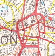
The earliest map of Wolverhampton was drawn by Isaac Taylor in 1750. Whilst the entire area of the then-town is shown, it pretty much only covers the present city centre. Looking at the map and comparing it with the modern layout of the city centre, several things stand out. A large number of the present main streets are present (although occasionally renamed): High Green (now Queen Square) is located right in the centre, whilst several modern radial routes are present on the map: Stafford Street (now A449), Broad Street (A4124), Bilston Street (A41), Dudley Street (A459), Worcester Street (A449) and Chapel Ash (A41/A454) are all obvious. The road out towards Willenhall and Walsall is, however, not Horseley Fields (now A454) but Walsall Street, which today is only a minor road, whilst Waterloo Road, Cleveland Street and Darlington Street do not yet exist.
By 1821, the Ordnance Survey had visited in connection with the Parliamentary Reform Act, and the map they produced extends out much further, allowing a look across most of the modern city and sometimes a little beyond. The pattern of streets in the city centre has got a little more like today's, though there are some noticeable differences further out. In Bilston, what is now A41 Wellington Road to the north of the town centre does not exist, and all traffic takes a dog-leg through the town centre using Wolverhampton Street (now B4162), then passing along High Street and Church Street before heading back towards Birmingham. In Willenhall, the present B4464 New Road does not exist, and all traffic passes directly through the town centre. Other places show less changes: Wednesfield, for example, shows the modern street pattern in the town centre (bar Alfred Squire Road, which was constructed in the 1960s), whilst Sedgley also shows pretty much the modern street layout.
However, the remainder of that decade would show quite a number of changes in a short stretch of time: the 1835 Ordnance Survey Old Series mapping being very obviously different to that coming before. In the city centre, Darlington Street had been constructed by the Town Commissioners, opening in 1823 and had become the major route to the west. Waterloo Road (originally, rather confusingly called Wellington Road, which wasn't the road to the nearby town of Wellington, Shropshire) came into being in the 1830s. Meanwhile, in Willenhall, New Road had been constructed, forming a bypass of the town centre that was later bypassed again in the 1970s by the now-B4590 to the south, and again in the 1990s by the A454 Black Country Route.
The largest change, however, was down to one man: Thomas Telford came to town with his improved London - Holyhead road, and with it came several major changes. In Bilston, Wellington Road (now A41) was constructed, whilst in the city centre, Cleveland Road was completed and became the main through route along Telford's new road. Out to the west, there was also improvement at Tettenhall, where the steep Old Hill was a problem to traffic. Telford's plan was to bypass the ridgeline altogether, and construct a new route towards Shrewsbury that would have involved a completely new line via Aldersley, meeting the present A41 at The Wergs. However, the Wolverhampton Turnpike Trust, who dealt with the road disagreed with Telford (as they did again with the second plan for a rising tunnel), and instead created The Rock, a deep cutting through the ridge which is a clear landmark on the road today. At the same time, they created the modern bridge over the Staffordshire and Worcestershire Canal, moving the line of the road very slightly northwards. Telford was forced to bow to their wishes, and his proposed new route was not constructed. After Telford, the new roads dried up once more, and the road network expanded simply to serve the expanding suburbs.
In 1927, lots happened. But rather oddly perhaps, it all happened over three days in November...
Firstly, on Wednesday 2 November 1927, the A4123 Wolverhampton - Birmingham New Road opened. The New Road (as it is still known) was proposed to relieve Telford's A41 Holyhead Road between the two cities which passed through town centres such as West Bromwich and Wednesbury. The New Road, therefore, bypassed all the town centres on its route, and indeed its route was deliberately chosen to avoid urban areas wherever possible. At the Wolverhampton end, the New Road connected to Thompson Avenue, a previously very minor radial route, the route of which is actually surprisingly difficult to plot on earlier mapping. The New Road was the first purpose-built inter-city highway of the twentieth century, opening seven years before the often-quoted A580 East Lancashire Road.
Then, on the Saturday of the same week, 5 November 1927, the first automatic traffic lights in the United Kingdom were installed in Princes Square. The lights were originally installed as a temporary experiment, though they were installed as a permanent feature in October 1928. The modern traffic lights in the location have dispensation from the Department for Transport to have the old-fashioned striped poles rather than the modern grey ones.
Another "first" for the United Kingdom road network came in the city in 1934, again at Princes Square, where the first pedestrian safety barriers were installed as an experiment paid for by the manufacturers, Steelway, and with assistance in design work of the Wolverhampton Borough Police and the Borough Engineer & Surveyor.
In 1960, work finally got underway on the A4150 Inner Ring Road. Construction of the road suffered from cost overruns, and a seeming inability to attract central government funding for the project, meaning that the planned grade-separation has never been constructed, despite the space being set aside even in the 1980s. The space for the grade-separation is mostly used as green space, although the St. Andrew's section has gardens and benches within it, and the St. Mark's section uses the space for car parking. Effectively, therefore, none of the through carriageways have actually been constructed, and the existing road is simply the collector-distributor lanes running between the junctions. Construction slowly moved its way around the city centre, with work starting on the St. John's section in the south between A449 and A4123, before generally progressing in a clockwise direction finishing with the St. David's section between A4124 and A454 in 1986.
Large amounts of through traffic were removed from the city centre in 1970, when the M5 to the south of the conurbation and M6 to the north were joined at Ray Hall. This was the first motorway construction in the area of the city, though back in 1923, the Northern and Western Motorway was proposed to have passed to the west, forming an effective bypass for through traffic. The M54 joined in the motorway party in 1983, forming both a link to the New Town of Telford to the west and an effective northern bypass for the city. Other proposed motorways such as the Western Orbital and the Bilston Link Motorway were not proceeded with.
However, in the late 1980s and early 1990s, a downgraded version of the Bilston Link Motorway was finally constructed - the A454 and A463 Black Country Route, that both forms an access from the city to the M6 to the east, and also a partial southern bypass.
Highways Management
Within the the urban area the M54 and A4510, as well as parts of A449, are Trunk roads and therefore managed by National Highways. Within the majority of the city, the road network is managed and maintained by City of Wolverhampton Council, though in the outer edges of the urban area the roads are managed by Staffordshire County Council. Other areas historically and functionally part of the city such as Willenhall and Sedgley are managed by Walsall MBC and Dudley MBC.
Named Junctions
Routes
The following roads run through the Wolverhampton area, both the urban area, the historic city area and the commuter belt.
| Route | To | Notes |
| The NORTH WEST, Stafford | ||
| The SOUTH, (M5) Birmingham | ||
| Birmingham (M6) | ||
| NORTH WALES, Telford | ||
| West Bromwich, Bilston | ||
| Whitchurch, Telford, Tettenhall, Codsall, Perton | ||
| Stafford, (M6 North) | ||
| Kidderminster, Penn, Wombourne, Stourbridge (A491) | ||
| Walsall, Willenhall, (M6South) | ||
| Bridgnorth, Compton | ||
| Cannock | ||
| Walsall | ||
| Dudley, Birmingham, Coseley, (M5) | ||
| Inner Ring Road | ||
| Walsall, Dudley (M6) | ||
| Sedgley, Dudley | ||
| Cannock, Darlaston | ||
| Wombourne | ||
| Shifnal | Part of Telford's London - Holyhead coaching road | |
| Darlaston, Walsall | ||
| Etingshall, Bilston | ||
| Great Bridge | ||
| Wednesfield, Brownhills | ||
| Ettingshall | ||
| Essington | ||
| Finchfield, Penn | ||
| Bilston | ||
| Coseley, Dudley (A4037) | ||
| Walsall, (M6,M5) | former route of A454 | |
| Coseley | ||
| Wednesfield, Willenhall, Bilston | part is former A463 and A4124 | |
| Bilston, Walsall | Number is unsigned | |
| Whitchurch | Now part of A41 | |
| now part of A4124 | ||
| Willenhall | Partially B4484, partially unclassified | |
| Road in city centre | ||
| Road in city centre | ||
| now part of A449 | ||
| now part of A4126 | ||
| Ocker Hill | now A4098 | |
| Possible mapping error in Wednesfield |
| Wolverhampton | ||||||||
| ||||||||
| ||||||||
| ||||||||
| ||||||||
| ||||||||
| ||||||||
| ||||||||
| ||||||||
| ||||||||
|


