Wolverhampton Outer Ring Road
| Wolverhampton Outer Ring Road | |||
 | |||
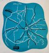
| Schematic of route taken from Wolverhampton of the Future, 1944 | |||
| |||
Shortly before World War 2, the Ministry of Transport proposed construction of a new route bypassing Wolverhampton to the south and west, with the initial phase being from A4123 from the Dudley direction around to A41 in the direction of Shrewsbury, with a second phase being a connection further around to A449 towards Stafford.
This proposal became known as the Wolverhampton Outer Ring Road, which is a slight misnomer as it was not proposed to create a full ring as no appropriate routing could be found for the eastern side of the city as it was felt to be too built-up. The closest available route was deemed to be the same as that of the also-planned Walsall Western Bypass, which became today's M6.
It was felt that the construction of the ORR would divert considerable amounts of through traffic away from the city centre, though it would work best in conjunction with the Inner Ring Road.
However, by the the time of The West Midlands Plan (1948), it was thought that the Outer Ring Road would "regrettably entail a considerable detour which might nullify its value". This seems to be based around the route chosen, where the ORR would have a junction with the A449 to the south of Lloyd Hill Roundabout at SO885947, whilst the junction with the A4123 was near to the then-edge of the County Borough near Parkfield Junction at SO924960, a considerable distance closer to the city centre; especially with the extension northeastwards to A4039 Parkfield Road at SO930965. This was presumably to take advantage of the wedge of open land that still exists today. It does however suggest that it would be possible to extend the ORR across the north-east of the city by stating "it is also possible bypassing the east of Essington and Wednesfield to create a route using open land to pierce as far as the Wolverhampton - Willenhall Road", which would leave only a short section remaining outside the proposal from A454 to A4123.
This school of thought continued in the 1952 Wolverhampton County Borough Development Plan, where it was described by the Council as "the long detour in particular would tend to make the road ineffective". However, they understood that Staffordshire County Council was considering retaining "at least" the part of the road between Lloyd Hill and Parkfield Road; but the Development Plan is quite sniffy about it, stating that "A new road of this length should not however be needed, since the traffic which it would carry could equally well use Parkfield Road, Goldthorn Hill and Penn Road, the future widening of all which will, in any case be necessary". Other than sections of A449 Penn Road, none of this mentioned widening has taken place to date.
No further information later than this has so far been identified, but the route had almost certainly been deleted by the mid-1960s, when the Ministry of Transport was trying to avoid paying for the grade-separation on the Inner Ring Road by requesting the Borough Engineers identify alternative routes for a north-south bypass through the eastern side of the city instead. As before, no suitable route could be found.
The only section of the Outer Ring Road that was ever constructed was along Wobaston Road, which was constructed by Wolverhampton County Borough Council just prior to World War 2 as a single carriageway with space for future dualling when connected to the remainder of the ORR. This dualling has now mostly been completed.
