Star.pngStar.pngStar.pngStar.pngStar grey.png

B4159

From Roader's Digest: The SABRE Wiki
Jump to navigation Jump to search
B4159
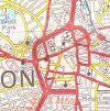
Location Map ( geo)
The B4159 is the Class II road to the left of the map
Cameraicon.png View gallery (5)
School Street
From:  Darlington Street, Wolverhampton (SO911986)
To:  Salop Street, Wolverhampton (SO911984)
Distance:  0.2 miles (0.3 km)
Met:  A449, A454, A41
Primary Destinations
Traditional Counties

Staffordshire

Route outline (key)
B4159 School Street, Wolverhampton
B4159 Victoria Street, Wolverhampton
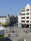
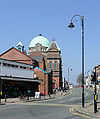
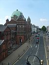
The former B4159 School Street

The original use of the B4159 number was for School Street, in Wolverhampton city centre.

By 1981, the B4159 had moved to Victoria Street

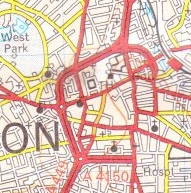
Quite why School Street was allocated a B classification in 1922 is unknown as its only function at the time was as a short, though busy, city centre street. It is so short that it can barely be seen on 1920s MoT Mapping, with the green B-road colouring being almost invisible.

At that time, the southern section of School Street south of Salop Street did not exist, and so the route of the A449 in the city centre was via Worcester Street and Victoria Street. Whilst it would make sense for the A449 to then continue north via North Street, the traditional route northwards to Five Ways, it seems to be the case that the original allocation multiplexed with the A454 along Darlington Street before proceeding north along Waterloo Road leaving B4159 as a short stub.

However, in the 1960s upon the construction of the southern section of School Street, the B4159 number was swapped with that of A449, with A449 taking the logical path from Waterloo Road to Penn Road via School Street (with the southbound section using the gyratory system via Pitt Street and Worcester Street), and B4159 being moved to the northern part of Worcester Street and Victoria Street before terminating on the A454 at Queen Square. This meant that the B4159 was finally declassified in 1986, in common with all roads within the city centre when the final section of the Inner Ring Road was completed.

B4159
Junctions
Places
Related Pictures
View gallery (5)
School Street, Wolverhampton - Geograph - 1820763.jpgLooking Down on School Street - Geograph - 1938936.jpgWolverhamptoncitycentre-1922.jpgWolverhampton city centre 1981.jpgLooking towards North Street, Wolverhampton - Geograph - 1891206.jpg
Other nearby roads
Wolverhampton
A41 • A446(M) • A449 • A454 • A457 • A459 • A460 • A462 • A463 • A464 • A464 (Oaken - Nantwich) • A4038 • A4039 • A4098 • A4123 • A4124 • A4126 • A4150 • A4444 • A4510 • B4155 • B4156 • B4157 • B4158 (Wolverhampton) • B4160 (Wolverhampton) • B4161 • B4162 • B4162 (Monmore Green - Deepfields) • B4163 • B4164 (Moxley - Ocker Hill) • B4200 • B4454 (Wednesfield) • B4464 • B4483 • B4484 • B4563 • B4590 • Bilston Link Motorway • C6 (Staffordshire) • C40 (Staffordshire) • C108 (Staffordshire) • C114 (Staffordshire) • C116 (Staffordshire) • C137 (Staffordshire) • C153 (Staffordshire) • C170 (Staffordshire) • C184 (Staffordshire) • C234 (Staffordshire) • C259 (Staffordshire) • C260 (Staffordshire) • C272 (Staffordshire) • C273 (Staffordshire) • C335 (Staffordshire) • C500 (Staffordshire) • E33 (London - Glasgow) • E34 (Old System) • Holyhead Road • M6 • M6 Toll • M54 • NCN81 • Northern and Western Motorway • T11 (Britain) • T14 (Britain) • T49 (Britain) • T50 (Britain) • U99 (Wolverhampton) • U110 (Wolverhampton) • U111 (Wolverhampton) • U112 (Wolverhampton) • U113 (Wolverhampton) • U114 (Wolverhampton) • U115 (Wolverhampton) • U116 (Wolverhampton) • U117 (Wolverhampton) • U118 (Wolverhampton) • U119 (Wolverhampton) • U120 (Wolverhampton) • U121 (Wolverhampton) • Western Orbital • Wolverhampton Outer Ring Road
B4100 – B4199
B4100(N) • B4100(S) • B4101 • B4102 • B4103 • B4104(N) • B4104(S) • B4105(E) • B4105(W) • B4106 • B4107 • B4108 • B4109 • B4110 • B4111 • B4112 • B4113 • B4114 • B4115 • B4116 • B4117 • B4118(W) • B4118(E) • B4119
B4120 • B4121 • B4122(N) • B4122(S) • B4123 • B4124 • B4125 • B4126 • B4127 • B4128 • B4129 • B4130 • B4131 • B4132 • B4133 • B4134 • B4135 • B4136 • B4137 • B4138 • B4139
B4140 • B4141 • B4142 • B4143 • B4144 • B4145 • B4146 • B4147 • B4148 • B4149 • B4150 • B4151 • B4152 • B4153 • B4154 • B4155 • B4156 • B4157 • B4158 • B4159
B4160 • B4161 • B4162 • B4163 • B4164 • B4165 • B4166 • B4167 • B4168 • B4169 • B4170 • B4171 • B4172 • B4173 • B4174 • B4175 • B4176 • B4177 • B4178 • B4179
B4180 • B4181 • B4182 • B4183 • B4184 • B4185 • B4186 • B4187 • B4188 • B4189 • B4190 • B4191 • B4192 • B4193 • B4194 • B4195 • B4196 • B4197 • B4198 • B4199
Earlier usesB4100 • B4105 • B4107 • B4111 • B4113 • B4115 • B4119 • B4128 • B4129 • B4139 • B4141 • B4143
B4150 • B4158(N) • B4158(S) • B4160 • B4162 • B4164 • B4177 • B4181 • B4184 • B4186 • B4192 • B4197


SABRE - The Society for All British and Irish Road Enthusiasts
Discuss - Digest - Discover - Help