A4444
| A4444 | ||||
| Location Map ( geo) | ||||
| ||||
| From: | The Lunt, Bilston (SO963968) | |||
| To: | Moxley (SO967958) | |||
| Via: | Black Country New Road | |||
| Distance: | 0.6 miles (1 km) | |||
| Meets: | A463, A41, A4038 | |||
| Primary Destinations | ||||
| Highway Authorities | ||||
| Traditional Counties | ||||
| Route outline (key) | ||||
| ||||
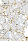
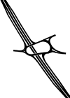
A4444 is the number allocated to the northern section of the Black Country Spine Road, between the A463 Black Country Route at The Lunt Junction and the A41 and A4038 at Moxley Junction. Constructed in the early 1990s, it is a remarkably dull dual carriageway whose only intermediate junction is a connection, on the northbound carriageway, serving a private warehouse facility.
The road runs parallel to and a short distance west of a stretch of the Walsall Canal, and a pelican crossing at the mid-point of the route keeps an old east-west link, which crosses the canal by means of Heathfield Bridge, open for pedestrians. The A4444 itself. which is a red route clearway, has no footways.
Original plans for the Spine Road show the A4444 number applied to the entire length of the road.
An image has been requested for this article.


