Star.pngStar.pngStar grey.pngStar grey.pngStar grey.png

A14 (Royston - Alconbury)

From Roader's Digest: The SABRE Wiki
Jump to navigation Jump to search
A14
Location Map ( geo)
Cameraicon.png View gallery (3)
Ermine Street
From:  Royston (TL356404)
To:  Alconbury (TL185780)
Via:  Huntingdon
Distance:  26.5 miles (42.6 km)
Met:  A1, A10, A45, A141, A505, A603, A604
Now part of:  A1198, A1307
Traditional Counties

Cambridgeshire • Hertfordshire • Huntingdonshire

Route outline (key)
A14 Royston - Alconbury
This article is about the road that is the former A14 between Royston, Hertfordshire and Huntingdon.
For the current A14, a major road between the Midlands and the Port of Felixstowe, see A14
.


Old North Road, Royston - part of the original A14

The recent history of the A14 is intimately tied up with those of two other roads, the A45 and the A604.

The A10 follows the "Old North Road" (the Roman Ermine Street) as far as Royston, where the A10 strikes north-eastwards to Cambridge. The Old North Road takes a more westerly route to meet the Great North Road (the A1) at Alconbury. This link was the original A14. When the M11 was completed, traffic on the Old North Road route was encouraged to use the new Motorway, gaining the A1 by way of the A604 to Godmanchester and then the A14. The A14 south of Godmanchester was later renumbered the A1198 to discourage through traffic. Use of the short section of A14 north of Godmanchester, now diverted to bypass Huntingdon, was encouraged, as it had a grade separated junction with the A1 at Alconbury, avoiding the roundabout at Brampton (A1/A604). This spur was later renumbered as a spur of the A604, and so the A14 ceased to exist.

When the current A14 was created in the early 1990s, in order to provide a continuous high quality route from the M6 to the Port Of Felixstowe, the A604 between Kettering and Cambridge was upgraded and renumbered A14, including its spur from Huntington to Alconbury. Thus, this short section was temporarily the A14 again, although it does not actually run on any part of the original. It has since become part of the A1307.

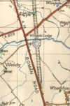


A14 (Royston - Alconbury)
Junctions
Roads
Places
Related Pictures
View gallery (3)
A14 (Original).pngThe North Star and Old North Road - Geograph - 1444759.jpgA604 - Collins 1982 - Coppermine - 162.jpg
Other nearby roads
Royston
Huntingdon
A1-A99
The First 99           A1  •  A2  •  A3  •  A4  •  A5  •  A6  •  A7  •  A8  •  A9  • A10 • A11 • A12 • A13 • A14 • A15 • A16 • A17 • A18 • A19
A20 • A21 • A22 • A23 • A24 • A25 • A26 • A27 • A28 • A29 • A30 • A31 • A32 • A33 • A34 • A35 • A36 • A37 • A38 • A39
A40 • A41 • A42 • A43 • A44 • A45 • A46 • A47 • A48 • A49 • A50 • A51 • A52 • A53 • A54 • A55 • A56 • A57 • A58 • A59
A60 • A61 • A62 • A63 • A64 • A65 • A66 • A67 • A68 • A69 • A70 • A71 • A72 • A73 • A74 • A75 • A76 • A77 • A78 • A79
A80 • A81 • A82 • A83 • A84 • A85 • A86 • A87 • A88 • A89 • A90 • A91 • A92 • A93 • A94 • A95 • A96 • A97 • A98 • A99
Motorway sectionsA1(M): (South Mimms - Baldock • Alconbury - Peterborough • Doncaster Bypass • Darrington - Birtley)
A3(M) • A8(M) Baillieston spur • A38(M) • A48(M) Cardiff spur • A57(M) • A58(M) • A64(M) • A66(M) • A74(M) • A92(M)
DefunctA1(M) Newcastle CME • A2(M) Medway Towns Bypass • A4(M) • A5(M) • A8(M) Renfrew bypass • A14 • A14(M) • A18(M) • A20(M) • A36(M)
A40(M): (Westway • Denham -Stokenchurch) • A41(M) • A42 • A46(M) • A48(M): (Port Talbot bypass • Morriston bypass) • A62(M) • A88 • A99
UnbuiltA2(M) Rochester Way Relief Road • A6(M): (Western route • Eastern route) • A14(M) (Expressway) • A34(M) • A48(M) Llantrisant Radial • A59(M) • A61(M)


SABRE - The Society for All British and Irish Road Enthusiasts
Discuss - Digest - Discover - Help