A39
| A39 | ||||||||||||||||||||||
| Location Map ( geo) | ||||||||||||||||||||||
| ||||||||||||||||||||||
| From: | Corston (ST701653) | |||||||||||||||||||||
| To: | Falmouth (SW816321) | |||||||||||||||||||||
| Distance: | 204 miles (328.3 km) | |||||||||||||||||||||
| Meets: | A4, B3116, A368, B3115, B3355, A37, B3114, B3135, B3139, A371, B3151, A361, B3141, M5, A38, B3339, B3191, A358, B3190, A396, B3225, B3234, B3223, A399, B3229, B3230, B3149, A3125, B3138, A361, B3232, B3233, A386, B3236, B3237, B3248, B3254, A3072, A3073, B3263, B3262, A395, B3314, B3266, B3267, A389, B3274, A3059, A392, A30, B3279, A390, B3284, B3289, A393, B3292, A394 | |||||||||||||||||||||
| Former Number(s): | A368, A369, A3076 | |||||||||||||||||||||
| Old route now: | B3275, A390 | |||||||||||||||||||||
| Primary Destinations | ||||||||||||||||||||||
Falmouth • Truro • Bude • Wadebridge • Barnstaple • Bideford • Bridgwater • Glastonbury • Bath • Minehead | ||||||||||||||||||||||
| Highway Authorities | ||||||||||||||||||||||
| Traditional Counties | ||||||||||||||||||||||
| Route outline (key) | ||||||||||||||||||||||
| ||||||||||||||||||||||
Route
The A39 is one of the longest routes in South West England, stretching from Bath in Somerset to Falmouth in Cornwall. Along the way, it passes some famous historical places - Wells and Glastonbury - tours genteelly along the Somerset, Devon and Cornish Coasts, before skirting to the north of Bodmin Moor and crossing the county to the historic port of Falmouth on the southern shore.
Work to create more in depth route descriptions for sections of the A39 is now underway as follows:
- A39/Bath - Wells
- A39/Wells - Bridgwater
- A39/Bridgwater - Williton
- A39/Williton - Porlock
- A39/Porlock - Lynton
- A39/Lynton - Barnstaple
- A39/Barnstaple - Bideford
- A39/Bideford - Bude
- A39/Bude - Camelford
- A39/Camelford - Indian Queens
- A39/Carland Cross - Falmouth
History
While the A39 has been extended to the north of its original route, and has been re-routed to the south, the central section has remained largely the same, albeit with a few bypasses and realignments. Much of the route, as with so many other A roads in the South West, follows old Turnpike roads, and in places even Roman Roads.
Notable locations along the route
Bideford Bridge
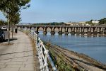
The old Bridge in Bideford now lies on the B3233, while the A39 passes the historic town on a huge modern bridge, soaring high over the river.
Opening Dates
| Year | Section | Notes |
|---|---|---|
| 1923 | Wembdon Bypass | Quantock Road. Taunton Courier reported on 4 July 1923 of a Council Meeting where the Surveyor had said that the new road would be ready next week. It avoided the notorious Wembdon Hill. The cost of the Unemployment Relief Road Scheme was £19,760. The Surveyor reported in May 1924 that the road had been accepted by the Ministry of Transport as a Class 1 Main Road. |
| 1927 | Parracombe Bypass | The 2 mile deviation at an altitude of 800 feet was opened on 21 October 1927 by Mrs Higgs of Holsworthy. Steepest gradient was 1 in 20 compared to 1 in 5 on the road through the village. During the 3 year construction it rained on 2 days out of 3. Cost £27,000. |
| 1938 | Pilton Bypass | The 0.8 mile bypass opened on 3 August 1938. It was 60 feet wide with a 30 foot concrete carriageway and 5 foot footpaths. Maximum gradient 1 in 17. Special kerbstones were fitted which gave a line of red lights on the near side and white on the right, as used previously in North Devon. It included a 48 foot span, 5 arch bridge over the River Yeo of reinforced concrete faced with granite. |
| 1968 | Truro Relief Road | Stage 1 - Morlaix Avenue: Arch Hill / Falmouth Road to Lemon Quay. One carriageway was reported as opening in a fortnights time by the 6 June 1968 West Briton and Cornish Advertiser. It may not have opened as A39. The Relief Road was completed in 1970. |
| 1969 | Street Inner Relief Road | Westway. The 1.3 mile road was fully opened on 3 April 1969. The road, apart from the end connections, had opened earlier. 24 foot carriageway apart from 0.5 mile of dual carriageway at the northern end. Forecast cost £340,000. |
| 1969 | Nether Stowey Bypass | Unauthorised signs showing the village services were put up on the bypass in Summer 1969 (per the Bristol Evening Post of 26 October 1970). A 26 March 1969 report said that a medieval pottery had been found on a new bypass site in the area indicating it was then still under construction, although it could have been a separate part from the main village bypass. The village Neighbourhood Plan stated that the bypass was built in 1968 and the 1968 OS Quarter inch map shows a bypass, albeit on a more northerly alignment. |
| 1970 | Truro Relief Road | Tregolls Road. The final section of the dual carriageway Relief Road was reported as opening in a few days time by the 11 May 1970 West Briton and Cornish Advertiser. |
| 1977 | St Columb Bypass | The 2.6 mile single carriageway road opened 3 June 1977. Contractor E. Thomas & Co., outturn works cost £1.6 million. The A3059 link road and southern bypass was planned at the same time. |
| 1985 | Marshgate Diversion | The 2.5 mile upgrade of an unclassified road from Otterham to Collamoor Head to provide a bypass of the village (and shorter route) was completed in May 1985 (per the 1985 National Roads England Report). Outturn works cost £2 million. Scheme mileage was 3.9 miles which indicates further 1.4 mile online upgrade to Wainhouse Corner. |
| 1987 | Bideford Bypass | The 5 mile single carriageway road was opened on 20 May 1987. It included the 650m long Torridge Bridge over River Torridge. The 8 span box girder bridge had 3 main spans of 90m with 24m clearance. Deck width was 13.3m. Consulting Engineer was MRM Partnership, Contractor Edmund Nuttall Ltd. |
| 1989 | Barnstaple Bypass | The 8 miles from Westleigh Junction (east end of Bideford Bypass) to Portmore Roundabout, Barnstaple was noted as open in the 27 July 1989 Construction News. Works cost £20.5 million. |
| 1991 | Carnon Downs Bypass | The dual carriageway was opened on 19 July 1991 by Christopher Chope, Minister for Roads and Traffic. Contractor was Costain Civil Engineering Ltd, tender price £3.5 million. It was extended westwards past Devoran in 2007. |
| 1993 | Wadebridge Bypass | Opened on 8 July 1993 by Robert Key, Minister for Roads and Traffic. Single carriageway. Contractor was Balfour Beattie, tender cost £8.3 million. It included a 450m nine-span bridge across the tidal River Camel. Part was A389. |
| 1994 | Penryn Bypass | The 2.5 mile southern section from Kernick Roundabout to Ponsharden Roundabout was opened on 25 April 1994 to complete the bypass. It included the 3 span Kernick Viaduct. Contractor was Alfred McAlpine, cost £5.7 million. The northern bypass section utilised the previous A394 from Treluswell Roundabout, south of Burnthouse, to Treliever Roundabout and the previously unclassified Mabe Bypass between Treliever Roundabout and Kernick Roundabout which had opened in 1989. |
| 1995 | Glastonbury Western Relief Road | Work started on 11 July 1994 with a completion date of April 1995. It may have opened later. Contractor was Birse Construction. |
| 1996 | Wells Relief Road | The first section to be opened was from Portway to, and including, the new Whiting Way. Wells Journal of 23 May 1996 reported that it was to be opened in the next couple of weeks. The western section, Strawberry Way, from Portway to Glastonbury Road was to be opened within the next few days per the Wells Journal of 8 August 1996. The A371 Dulcote Link (East Somerset Road and Bishops Park Way) was opened on 5 November 1996. Traffic had used the road on 1 November 1996 for a short period after a prankster had removed the cones. |
| 1997 | Wells Relief Road | The final northern section, Mountery Road, was opened on 10 January 1997 by John Watts, Transport Minister. Contractor was Christiani and Nielson, total cost £13 million. |
| 1997 | Trispen Bypass | The 3.25 mile single carriageway road from A30 Carland Cross to south of Trispen was opened on 5 December 1997 by William Hosking, Cornwall County Council Chairman. |
| 2003 | Bridgwater Northern Distributor Road | The 1.6 mile road from Whitegate Roundabout, Quantock Road to The Drove, adjoining Bristol Road was fully opened on 31 January 2003. The 0.75 mile first section from Chilton Road to Wylds Road, with a bridge over River Parrett, had opened in September 2001. |
| 2007 | Devoran Bypass | Opened on 31 July 2007. A westwards extension of the 1991 Carnon Downs Bypass dual carriageway to Carnon Gate Roundabout, then a single carriageway crossing of the Carnon River valley on an embankment to rejoin the existing road at Visick’s Bend. |
External links
legislation.gov.uk
- The A39 Trunk Road (Portmore Roundabout to the Devon/Cornwall County Boundary) (Detrunking) Order 2002 - This order is the second of two which removes trunk status from the A39 following the 1998 consultation A New Deal for Trunk Roads in England
- The A39 Trunk Road (Devon/Cornwall County Boundary to Indian Queens Cornwall) (Detrunking) Order 2002 - This order is the first of two which removes trunk status from the A39 following the 1998 consultation A New Deal for Trunk Roads in England
Videos


