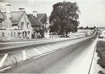
A1(M)/Alconbury - Peterborough
| A1(M) | ||||||||||||||||||||||
| Location Map ( geo) | ||||||||||||||||||||||
| ||||||||||||||||||||||
| Alconbury – Peterborough | ||||||||||||||||||||||
| From: | Alconbury, Huntingdonshire (TL189752) | |||||||||||||||||||||
| To: | Orton Southgate, Huntingdonshire (TL141942) | |||||||||||||||||||||
| Distance: | 12.4 miles (20 km) | |||||||||||||||||||||
| Meets: | A1, A15, A605, A1139, A1307, B1043 | |||||||||||||||||||||
| Former Number(s): | A14(M) | |||||||||||||||||||||
| Primary Destinations | ||||||||||||||||||||||
| Highway Authorities | ||||||||||||||||||||||
National Highways | ||||||||||||||||||||||
| Counties | ||||||||||||||||||||||
Huntingdonshire | ||||||||||||||||||||||
| Route outline (key) | ||||||||||||||||||||||
| ||||||||||||||||||||||
| Junction List | ||||||||||||||||||||||
| ||||||||||||||||||||||
Route
When it opened, it was perhaps considered to be one of the most over engineered sections of motorway in the country - it was evident that this was part of a bigger plan. This section of the A1(M) starts just to the south of Alconbury, bypassing to the east of the village along the 1950s line of the A1. Just a mile from the start of the motorway it is joined by a spur from the A14, an unsigned motorway originally referred to as the A604(M), and more recently referred to as the A14(M).
North of the A14 spur, the motorway widens out to D4M, following a very bland and straight route north past Sawtry (Junction 15), Conington and Glatton, before introducing an exciting blip to the east to bypass Stilton (Junction 16), where the A15 creates a useful short cut to Peterborough and the new town area of Hampton Vale. The route continues northwards, rejoining the straight line of the old Roman Road again to its junction with the A605 and A1139, which forms a key route into Peterborough from the Midlands via the A14.
This section of the A1(M) is maintained under a DBFO agreement which runs until 31 March 2026 and is managed by Road Management Services (Peterborough) Ltd.
History
Originally a Roman Road called Ermine Street, the Great North Road, became the first route upon the Turnpike Road Act of 1663, with Shilton being one of the locations where tolls were collected. The route was allocated the number A1 in 1922, and became the key route between London, York, and Scotland.
In 1956 the government announced that the A1 would be improved into a major north-south route designed to cope with modern traffic conditions, and that the County Councils would act as agents to the Ministry of Transport to upgrade the then narrow and winding single carriageway to dual carriageway. The first of these schemes was a short section between Alconbury and Conington which opened in 1957, while a later section bypassing Stilton was opened in 1958.
In April 1996, work began to upgrade this length of dual carriageway to full motorway standard under a finance process known as DBFO, where the cost of the construction and maintenance is provided up front by a private finance company who charges a shadow toll to the DfT for the number of vehicles using the road over the contract term. The cost of the upgrade was estimated at £128m, and the upgrade was first opened to traffic on 31 October 1998.
A series of bypasses where constructed through the 1950s and 1960s around the new suburban commuter areas of Middlesex and several market towns in the Midlands. These schemes massively reduced travel times on the Great North Road and provided vital relief for traffic-choked towns.
Improvements
Since the completion of the upgrade to motorway in 1998, no further improvements other than maintenance such as resurfacing have been made to the main line. The Fletton Parkway Interchange has had some widening work in 2015.
Future
This part of the route falls into the A1 East of England study, published in 2016.
Links
Roads.org.uk
Roads UK
legislation.gov.uk
- The A1(M) Motorway (Alconbury to Fletton Parkway Section) and Connecting Roads Scheme 1993 - this order allows the construction of a new motorway between Alconbury and Fletton Parkway
- The A1 Trunk Road (Alconbury to Fletton Parkway Improvement) (Detrunking) Order 1993 - this order detrunks a secton of the A1 between Alcolnbury and Fletton Parkway with the opening of the new motorway
gov.uk
- A1 east of England strategic study: interim report (18 August 2016)


