A26
| A26 | ||||||||||||||||||||||
| Location Map ( geo) | ||||||||||||||||||||||
| ||||||||||||||||||||||
| From: | Maidstone (TQ753553) | |||||||||||||||||||||
| To: | Newhaven (TQ449016) | |||||||||||||||||||||
| Distance: | 49 miles (78.9 km) | |||||||||||||||||||||
| Meets: | A20, B2163, A228, B2016, A227, B2017, A2014, A21, B2176, A264, B2023, A267, B2157, B2100, A272, A22, A2029, A27, A259 | |||||||||||||||||||||
| Former Number(s): | B2109 | |||||||||||||||||||||
| Old route now: | A27 | |||||||||||||||||||||
| Primary Destinations | ||||||||||||||||||||||
| Highway Authorities | ||||||||||||||||||||||
| Traditional Counties | ||||||||||||||||||||||
| Route outline (key) | ||||||||||||||||||||||
| ||||||||||||||||||||||
The A26 is a cross-country A-road across the South Downs, passing through some of the more affluent places in this part of the country.
Route
Maidstone – Tunbridge Wells
The A26 starts at the southwest corner of the A20 gyratory near Maidstone West Station. From here it runs westward out through Barming and along the Medway valley to Wateringbury. It meets the A228 at a roundabout in Mereworth, and from here the heading turns southwesterly and the route becomes primary.
The A228 now multiplexes with us for a short way: originally it finished at Mereworth, but it's been much extended recently and has taken over former stretches of the B2016 and B2015. (The A228, by the way, is a much better route to Tunbridge Wells from here than the A26 and is signed as such, while the A26 is signed Tonbridge.)
We're well and truly in the countryside now, and there are lots of seemingly pointless bends in the road, and little lanes joining on either side, signed with fingerposts (sadly the new-style ones though). Through Hadlow, and we enter Tonbridge. The A26 used to go into town, down the High Street and past the station, but it was later diverted around the Tonbridge Eastern Relief Road. This was built in two stages with Woodgate Way (the Somerhill Link), completing the road, opening in 1992. It's a very circuitous route, past industrial estates and over lots of roundabouts, and I'm not sure I'd recommend it, unless you wanted to go southeast on the A21 (but then you'd have used the A228!).
So to resume the route of the A26, you'd think you just have to hop onto the A21 for a bit and then come off again. Now, here's the good bit: there's no access to the A26 southbound from the A21 northwestbound at Quarry Hill junction, so you have to follow the A2014 heading back in towards the town back and then come out again. In other words, you might just as well have gone through the town centre... Quarry Hill, apart from being only limited access, is quite an exciting junction: it's like a roundabout gone wrong, as the two carriageways of the A26 are separated at this point, but there are some interesting bridges, etc. Movement from the A21 southeastbound to the A26 (Quarry Hill Road) into Tonbridge is possible, but you have to go round 270 degrees instead of just turning left.
Tunbridge Wells – Newhaven
The A26 used to go through the centre of Tunbridge Wells, but Grosvenor Road - Mount Pleasant Road - Vale Road has since been declassified, and the A-road now follows London Road to the west of the town centre. Once out of Tunbridge and into Sussex, we come to a section between Eridge and Crowborough which was improved in the early 1990s with a new alignment and the addition of climbing lanes. The route then passes through Crowborough without too much trouble, and on to Uckfield, where we multiplex with the A22 around the bypass then split again at a roundabout in Ridgewood. The South Downs soon loom large, and we enter Lewes.
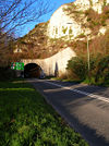
The centre of Lewes is a bit of a nightmare, or has been the few times that I've been down there, as the streets are horrendously narrow and congested. In fact, during the 1970s, there was the threat of sending the A27 on a 'relief road' straight through the middle, and widening the A26. Instead these plans were thrown out, and a tunnel built instead, with the A27 routed onto a bypass outside the town. So the A26 no longer goes through the middle of town, but through the Cuilfail Tunnel.
Originally, the A26 used to go out through the west of Lewes, then along the present A27 to finish in Brighton. Then after World War II the A27 was extended further east and the A26 was truncated in Lewes. However, when the Lewes bypass was built, the A26 was extended, via a multiplex with the A27, to make the final descent into Newhaven, along the ex-B2109, where we finish on the A259 just like several other A2x roads. From here you can catch a ferry into Dieppe.
Opening Dates
| Year | Section | Notes |
|---|---|---|
| 1930 | Tonbridge: Cornwallis Avenue | Opened on 7 March 1930 by Lord Cornwallis, County Council Chairman. It removed the dangerous bend at The Stair. Varieties of trees were planted with the first letter spelling out the name Cornwallis. A report in May 1929 about the construction stated that it was a mile in length with widening for a further half mile. 60 foot wide with a 30 foot carriageway and concrete. Forecast cost £13,000. |
| 1992 | Tonbridge Eastern Relief Road | Stage 2: Woodgate Way (Somerhill Park Link Road) from Vale Road to Vauxhall Interchange, Pembury Road was reported by the 10 April 1992 (Friday) Kent and Sussex Courier as having opened on Friday. Contractor was May Gurney, cost £2.7 million. A section of Tudeley Lane (B2017) was closed 3 days later. |
| 1992 | Boarshead - Eridge Improvement | East Sussex and Brighton and Hove Record Office has an online summary record for 1 July 1992. It mentions opening by Harry Hatcher, Chairman of the Council. Parts may have opened earlier. 2.4 mile. |
Links
BBC News


