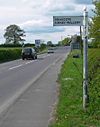
B582
| B582 | ||||||||||||||||||||||||||||
| Location Map ( geo) | ||||||||||||||||||||||||||||
| ||||||||||||||||||||||||||||
| From: | Belcher's Bar (SK409083) | |||||||||||||||||||||||||||
| To: | Stoneygate (SK615024) | |||||||||||||||||||||||||||
| Via: | Desford, Enderby, Wigston | |||||||||||||||||||||||||||
| Distance: | 20.2 miles (32.5 km) | |||||||||||||||||||||||||||
| Meets: | A447, B585, A47, B4114, A426, B5366, A5199, B5418, B5403, A6, A6030 | |||||||||||||||||||||||||||
| Old route now: | B667 | |||||||||||||||||||||||||||
| Highway Authorities | ||||||||||||||||||||||||||||
| Traditional Counties | ||||||||||||||||||||||||||||
| Route outline (key) | ||||||||||||||||||||||||||||
| ||||||||||||||||||||||||||||
The B582 is a complicated road near Leicester.
It starts on the A447 at Belcher's Bar and heads clockwise around Nailstone before reaching a T-junction after about a mile. The road TOTSOs left here and immediately afterwards runs head-on into the B585. Both roads TOTSO here and the B585 is the dominant partner in a multiplex lasting a couple of miles to the edge of Newbold Verdon. After a TOTSO left, the B585 TOTSOs right almost immediately and the B582 continues ahead.
Until at least the 1990s the B582 started further south on the A447, at Osbaston Toll Gate. It headed east through Barlestone to meet the B585 on the edge of Newbold Verdon. This road is now unclassified and denied to heavy vehicles.
Continuing east the B582 skirts Newbold Verdon before going through Desford and then reaching the A47 at Leicester Forest West, a tiny place compared to its eastern counterpart, which has given its name to a service station on the M1. The A-road is crossed via a staggered crossroads controlled by traffic lights. The B582 continues southeastwards before reaching Enderby. It goes over the M69 and M1 respectively at either end of the village. The road then crosses the B4114 (former A46) at a roundabout before going over the Nuneaton to Leicester railway line and reaching a roundabout on the A426 Blaby bypass. Originally it met the A-road in the centre of the village.
The B582 multiplexes north along the A426 beyond the end of the bypass and under the railway line. It then turns right at traffic lights to regain its number and go under the railway line again before continuing through the southern suburbs of Leicester (although it is not within the city limits at this point). After crossing the Midland Main Line the road enters Wigston Magna where it meets the A5199 (former A50) at traffic lights to the south of the town centre. It multiplexes north to a roundabout where it regains its number and heads north east to Oadby. Here it zigzags across the pre-bypass A6 by means of a mini-roundabout and a TOTSO. After crossing the current line of the A6 at traffic lights the road continues north, almost back into open country, before it turns left at a mini-roundabout to enter the city of Leicester.
At one time the B582 took the next turn right to continue through Evington to end on the A47 in Thurnby (part of which is now the B667). However, it now continues ahead past the golf course to end at a roundabout on the A6030.
History
Originally the B582 only ran between the B568 (now A5199) in Wigston Magna and the A6 in Oadby. By 1932 it had been extended both ways, so running from Osbaston Toll Gate to Thurnby. The two ends were tweaked more recently.


