Black Country Route
| Black Country Route | |||
| Location Map ( geo) | |||
| |||
| Location | |||
| Bilston • Willenhall | |||
| County | |||
| Staffordshire | |||
| Highway Authority | |||
| Wolverhampton • Walsall | |||
| Scheme Type | |||
| Bypass | |||
| Opening Date | |||
| in phases between 1986 and 1995 | |||
| On road(s) | |||
| A454 • A463 | |||
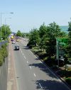
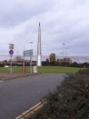
The Black Country Route is a completed road scheme on the south and east sides of Wolverhampton. It forms part of the A454 and A463, meeting junction 10 of the M6 at the eastern end, and the A4123 at the western end; and was designed for several different regeneration and growth projects, including as a bypass for the town centres of Bilston and Willenhall, and to open up development on the former Bilston Steelworks site.
It is a downgraded successor to the unbuilt Bilston Link Motorway, with the eastern half of the route taking the planned line of the motorway and the western half taking a more northerly line much closer to Bilston town centre. The eastern half of the route is grade-separated, whilst the western half features flat roundabouts.
It opened in several sections between 1986 and 1995, although the initial stage of associated route of The Keyway, the western section of the Willenhall Bypass, opened in March 1974.
| Section | Description | Completion Date | Highway Authority | Notes |
|---|---|---|---|---|
| 1 | M6 J10 to Owen Road | 10 Feb 1995[1] | Walsall | |
| 2 | Owen Road to The Keyway | October 1985[2] | Walsall | Refers to original section later removed and replaced, which does not appear on Landranger published 1987[3]. |
| 3 | Keyway Junction to Oxford Street | 21 July 1995[4] | Wolverhampton/ Walsall | Final section to be completed, although section between Oxford Street Island and Vulcan Road Island may have opened earlier than the rest. Opened by Neil Kinnock, European Commissioner for Transport. |
| 4 | Oxford St to Coseley Road | c. 1992 | Wolverhampton | Appears on Landranger in 1992[5]. Included short link to A4039. |
| 5A | Coseley Road to Spring Vale | c. 1990 | Wolverhampton | Appears on Landranger in 1990[6]. Ended on a temporary terminus with Coseley Road. |
| 5B | Spring Vale to Anchor Lane | c. 1990 | Wolverhampton | Appears on Landranger in 1990[7] |
| 5C | Anchor Lane to A4123 | Early 1986[8] | Wolverhampton | Documentary and mapping evidence is contradictory, does not appear on Landranger published 1987[9] |
References
- ↑ Commercial Motor archive (23 Feb 1995)
- ↑ Transport Policies and Programme Submission - Wolverhampton Borough Council (1986) page: 50
- ↑ Landranger Sheet 139 Revision A//*/*/*/* - Ordnance Survey (1987)
- ↑ Sandwell Evening Mail - (21 July 1995)
- ↑ Landranger Sheet 139 Revision B1 - Ordnance Survey (1992)
- ↑ Landranger Sheet 139 Revision B - Ordnance Survey (1990)
- ↑ Landranger Sheet 139 Revision B - Ordnance Survey (1990)
- ↑ Transport Policies and Programme Submission - Wolverhampton Borough Council (1986) page: 50
- ↑ Landranger Sheet 139 Revision A//*/*/*/* - Ordnance Survey (1987)


