Star.pngStar.pngStar.pngStar.pngStar grey.png

B9046

From Roader's Digest: The SABRE Wiki
Jump to navigation Jump to search
B9046
Location Map ( geo)
Cameraicon.png View gallery (2)
From:  Whome (ND361937)
To:  Pan (ND373942)
Distance:  1.1 miles (1.8 km)
Meets:  B9045, Pier
Highway Authorities

Orkney Islands

Traditional Counties

Orkney

Route outline (key)
B9046 Whome - Pan

The B9046 is the shorter of two classified roads on Flotta in the Orkney Islands.

Heading east

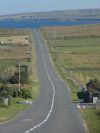
It starts at a crossroads on the B9045 in Whome, where that road has to TOTSO, giving the B9046 the mainline as it heads eastwards across the island. It passes though the main settlement of Whome, although on an island with a resident population of only around 80 people, this is just a small housing estate opposite a school and community centre. The long straight continues east for about three quarters of a mile, before dropping to single track at a junction. It then turns sharply left a short distance later, with another kink left as it drops down to the Pier at Pan on Pan Hope, where the route now ends.

History

The B9046 in 1922

As originally classified in 1922, the B9046 may have been even shorter than it is now. The MOT Map shows that a little over half way along the main straight, the route turned north to end at Lurdy. This is the home of the island shop, post office and filling station, although now with limited hours, and the MOT map marks the Post Office further east. However, the 1922 Road Lists gives the rather vague terminus of Pan Hope, which could mean anywhere along the shore. The 1932 OS Ten Mile Map appears to show the current route, although the scale makes it difficult to be certain, which suggests that the change was made early on.

The 1922 MOT Road List defines this route as: School - Pan Hope


B9046
Related Pictures
View gallery (2)
Whome on Flotta - Geograph - 427680.jpgFlotta- the B9046 heads across the island - Geograph - 4714617.jpg
Other nearby roads
Orkney
NCN1 • A960 • A961 • A962 • A963 • A964 • A965 • A966 • A967 • A986 • B9040 (Orkney) • B9041 • B9042 • B9043 • B9044 • B9045 • B9047 • B9048 • B9049 • B9049 (Quoyness) • B9050 • B9051 • B9052 • B9053 • B9054 • B9054 (Finstown - Twatt) • B9055 • B9056 • B9057 • B9058 • B9059 • B9060 • B9061 • B9062 • B9063 • B9064 • B9065 • B9066 • B9067 • B9068 • B9069 • B9070 • B9148
B9000 – B9099
B9000 • B9001 • B9002 • B9003 • B9004 • B9005 • B9006 • B9007 • B9008 • B9009 • B9010 • B9011 • B9012 • B9013 • B9014 • B9015 • B9016 • B9017 • B9018 • B9019
B9020 • B9021 • B9022 • B9023 • B9024 • B9025 • B9026 • B9027 • B9028 • B9029 • B9030 • B9031 • B9032 • B9033 • B9034 • B9035 • B9036 • B9037 • B9038 • B9039
B9040 • B9041 • B9042 • B9043 • B9044 • B9045 • B9046 • B9047 • B9048 • B9049 • B9050 • B9051 • B9052 • B9053 • B9054 • B9055 • B9056 • B9057 • B9058 • B9059
B9060 • B9061 • B9062 • B9063 • B9064 • B9065 • B9066 • B9067 • B9068 • B9069 • B9070 • B9071 • B9072 • B9073 • B9074 • B9075 • B9076 • B9077 • B9078 • B9079
B9080 • B9081 • B9082 • B9083 • B9084 • B9085 • B9086 • B9087 • B9088 • B9089 • B9090 • B9091 • B9092 • B9093 • B9094 • B9095 • B9096 • B9097 • B9098 • B9099
Earlier iterations: B9002(E) • B9002(W) • B9003 • B9005 • B9013 • B9014 • B9019 • B9038 • B9040 • B9049 • B9054
B9071 • B9076 • B9077 • B9078 • B9079 • B9080 • B9085 • B9093 • B9095 • B9098

SABRE - The Society for All British and Irish Road Enthusiasts
Discuss - Digest - Discover - Help