St Peters Square
| St. Peter's Square | |||
| Location Map ( geo) | |||
| |||
| Location | |||
| Wolverhampton city centre | |||
| County | |||
| Staffordshire | |||
| Highway Authority | |||
| Wolverhampton | |||
| Junction Type | |||
| Square | |||
| Roads Joined | |||
| unclassified | |||
St. Peter's Square is a location within Wolverhampton city centre with a confusing history, even to native Wulfrunians. Historically, it was neither a square, nor a junction, but now it is both of those things, even if the connecting streets are now all pedestrianised...
Before the 1970s
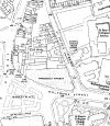
The historic location of St. Peter's Square is somewhat of a misnomer. Whilst the more famous St. Peter's Square in Rome might be more readily brought to mind, the Wulfrunian version wasn't a square at all, but a simple street running northwards away from St. Peter's Collegiate Church, past the side of the old Deanery ending on Charles Street, which is now underneath the location of the A4150 Inner Ring Road; and the rather marvellously named Tinshop Yard; with a "spur" that turned east accessing several properties turning the street into an L shape. Other than the replacement of the Deanery with the Wolverhampton and Staffordshire Technical College (now the University of Wolverhampton) in the early twentieth century, not much happened to St. Peter's Square. Fundamentally, it was a relatively unimportant street within the city centre that didn't really go anywhere, or serve anything except for the properties directly on it.
Redevelopment
It had long been a desire of the local authority to redevelop large parts of the city centre, with Wolverhampton of the Future being published in 1944. This first brought to life the desire to construct an Inner Ring Road, and also included the redevelopment the area to the west of St. Peter's Church with a new municipal administration building to replace the Town Hall. This was proposed to be located to the west of St. Peter's Square, replacing the old Wholesale, Retail and Open Markets which were located to the west of Exchange Street.
This came to pass within several stages, and to a slightly different layout to the original plans meaning that the eventual Civic Centre lay across the end of Wulfruna Street, and the layout of St. Peter's Square was rearranged to become a car park on the northern section with a pedestrian walkway along the side; with the southernmost part effectively becoming a turning circle for the new layout of Wulfruna Street.
Ironically, this meant that St. Peter's Square had finally become a square.
Confusion
Effectively, St. Peter's Square disappeared entirely from consciousness, with the "turning circle" section simply being thought of, and often mapped as, part of Wulfruna Street. Only the car park to the north kept the old name, with one exception - the street address of the Civic Centre was listed as "St. Peter's Square".
Unfortunately, the area to the south of the Civic Centre, historically where the Market Hall stood on the corner of Exchange Street and Cheapside was redeveloped as an open pedestrianised square. As befitting its location immediately to the west of St. Peter's Church, a mural was placed in the bricks that formed the surface of the square of the keys of St. Peter. In addition, the main entrance to the Civic Centre lay on this new, unnamed, open square.
Over the next few years, more and more people came to believe that the unnamed open square was, in fact, St. Peter's Square rather than the actual location to the northeast. This situation led to more and more confusion.
Resolution, sort of?
Eventually, the City Council saw fit to address the problem. They announced in the early 21st century that the formerly unnamed square would actually become St. Peter's Square. Problem solved - the square that by then everyone thought was called St. Peter's Square finally was.
However, they failed to rename the original road, meaning that today the Civic Centre is surrounded on three sides by different areas, all named "St. Peter's Square" - as well as the 1960s pedestrian square to the south there are still street nameplates attached to the University building that say "St. Peter's Square" on them to the east, and the car park to the north of the Civic Centre is also still called "St. Peter's Square".
Even more confusingly, according to the National Street Gazetteer, the pedestrian only walkway between the large open square to the south and the original "turning circle" section is also called "St. Peter's Square", meaning that there are at least four distinctly different adjoining areas with the same street name.
However, the pedestrian walkway section of the northernmost part of the original street alongside the University buildings has been recently renamed Deanery Place, although the car park section remains "St. Peter's Square". Whether this adds to or removes some of the confusion is difficult to say.
However, one thing is certain - the City Council did not learn from the issues regarding the confusing nature of St. Peter's Square, and in 2011 managed to create a similar confusion a few hundred yards away at Victoria Square.


