Star.pngStar.pngStar.pngStar.pngStar grey.png

Bentley Interchange

From Roader's Digest: The SABRE Wiki
Jump to navigation Jump to search
Bentley Interchange
Location Map ( geo)
M6, Junction 10 - Geograph - 3116171.jpg
Cameraicon.png View gallery (5)
Location
Bentley
County
Staffordshire
Highway Authority
National Highways
Junction Type
Roundabout Interchange
Roads Joined
M6, A454, B4464
Junctions related to the A454
Junctions related to the B4464

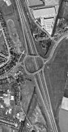
Bentley Interchange is junction 10 of the M6 motorway, forming a major access to the city of Wolverhampton and the large town of Walsall. It is a light-controlled roundabout junction, and featured the first ramp metering system in Great Britain, which was operational from 26 May 1986[1]. The roundabout is now so busy that it has been bypassed by left-turn filters on all entrances bar that from B4464. Work started in 2020 to replace the original straight bridges on the roundabout with wider curved ones.

On the M6, it is signed for both Wolverhampton (Cen & E) and Walsall.

Its name can be confused with Bentley Junction, which is just to the west on A454 Black Country Route.

History

Prior to the M6 in 1963
Temporary terminus on the 1967 OS One Inch map
Fully open on the 1972 OS One Inch map with space for the Bilston Link Motorway in the southwest corner

The original route of A454 through the area ran slightly to the north of the present junction, along the line of B4464 before following the line of Wolverhampton Road West and Wolverhampton Road before proceeding along the present A454 line towards Walsall town centre.

Opened in 1966, the junction formed a temporary terminus for the M6 until the section towards junction 9 opened in 1968. The first phase continued a few hundred yards beyond the junction ready for completion. As originally constructed, the roundabout was an off-set shape in order to allow for the future construction of the Bilston Link Motorway, which was to improve access both into Wolverhampton city centre, and to act as a bypass for the town of Willenhall.

Whilst the Bilston Link Motorway remained unbuilt, the space was utilised in the late 1980s for a downgraded version called the Black Country Route which was allocated the A454 number with the original route of A454 at the junction being allocated the B4464 number. Access to B4464 west of the junction is restricted to bus traffic; other traffic must use A454 and exit at the first junction, Bentley Junction, to access B4464.

With the increasing load on the junction, there have been several proposals to improve the junction, usually by adding grade separation for traffic to continue along A454. This proposal is constricted by a lack of space on the western side of the junction, although there is sufficient space on the eastern side. These proposals have not progressed beyond the initial phases, although in 2015 it was announced that the capacity of the junction would be improved by replacement of the bridges over the motorway with wider ones, with work starting on the replacements in 2020.

Alternative early design

An alternative layout planned in the late 1950s shows this design instead of the junction that was built.

Routes

Route To Notes

M6

The NORTH WEST, Stafford, Telford (M54)

M6

The SOUTH, Birmingham

A454

W'hampton, Dudley (A463), Willenhall, Bilston

A454

Walsall, Cannock (A34), Brownhills (A452), Lichfield (A461), Walsall Manor Hospital

B4464

no access from roundabout

Bilston Link Motorway

References

Links

National Highways

BBC News


Bentley Interchange
Related Pictures
View gallery (5)
M6, Junction 10 - Geograph - 3116171.jpgM6 Motorway Heading North - Approaching Junction 10 - Geograph - 2721021.jpgIMG 5122.JPG M6 Motorway Junction 10.jpgBentley Interchange early proposal.pngBentley Interchange 1973.jpg
Other nearby junctions
Wolverhampton
Anson Junction • Battlefield Roundabout (Wolverhampton) • Bentley Bridge Island • Bentley Junction • Bilston Street Island • Bowmans Harbour Island • Broad Street Junction • Bull Ring (Sedgley) • Bull Ring (Willenhall) • Bull Stake • Bushbury Island • Chapel Ash Island • Coseley Road Island • Coven Heath Interchange • Coven Roundabouts • Elephant and Castle (Wolverhampton) • Essington Interchange • Featherstone Interchange • Fighting Cocks • Five Ways (Dunstall Park, Wolverhampton) • Five Ways (Merry Hill, Wolverhampton) • Five Ways (Wolverhampton City Centre) • Five Ways (Wolverhampton) • Fordhouses Roundabout • Four Ashes Junction • Fox Crossroads • Gailey Interchange • Gailey Island • Goodyear Island • Horseley Fields Junction • Keyway Junction • Laney Green Interchange • Leicester Square (Wolverhampton) • Lloyd Hill Roundabout • Merrills Hall Island • Midland Counties Dairy • Moxley Junction • Neachells Lane Island • New Cross Junction • New Invention Island • Oxford Street Island • Penn Road Island • Pickmere Roundabout • Portobello Island • Princes Square • Queen Square (Wolverhampton) • Saredon Interchange • Short Heath Interchange • Snow Hill Junction (Wolverhampton) • Spring Vale Island • St Peters Square • Stafford Place • Stafford Street Junction • Standeford Crossroads • The Dale • The Lunt Junction • Scotlands Island • Three Tuns Junction • Tong Interchange • Victoria Square • Vine Island Junction • Vulcan Road Island • Waterloo Road Junction • Western Way Interchange • Wood End Island
Walsall
Junctions on the M6
PresentM1 J19 Catthorpe • 1 Junction 1 • 2 Ansty • 3 Exhall • 3A/4 Coleshill • 4A Water Orton • 5 Castle Bromwich • 6 Gravelly Hill • 7 Great Barr • 8 Ray Hall • 9 Wednesbury • 10 Bentley • 10A Essington • 11 Laney Green • 11A Saredon • 12 Gailey • 13 Dunston • 14 Creswell • 15 Hanchurch • 16 Barthomley • 17 Sandbach • 18 Middlewich • 19 Tabley • 20 Lymm • 21 Woolston • 21A Croft • 22 Winwick • 23 Haydock Island • 24 Junction 24 • 25 Bryn • 26 Orrell • 27 Junction 27 • 28 Leyland • 29 Bamber Bridge • 30 Blacow Bridge • 31 Samlesbury • 31A Haighton • 32 Broughton • 33 Hampson Green • 34 Lune Valley • 35 Carnforth • 36 Crooklands • 37 Killington • 38 Tebay • 39 Shap • 40 Skirsgill • 41 Catterlen • 42 Golden Fleece • 43 Rosehill • 44 Kingstown • 45 Guards Mill
Former32A Broughton Roundabout • 35A Keer Level Roundabout
Unbuilt"6A" Perry Barr • "10A" Short Heath • "14A" M6 "Expressway" • "14A" M64 • "15A" M6 "Expressway" • "16A" M6 "Expressway" • "27A" Euxton • "33A" "Junction 33A"
Unenacted Extension to Glasgow"46" Gretna • "47" Kirkpatrick Fleming • "48" Eaglesfield • "49" Ecclefechan • "50" Lockerbie South • "51" Lockerbie North • "52" Johnstonebridge • "53" Beattock • "54" Elvanfoot & Crawford • "55" Abington • "56" Millbank • "57" Poniel • "58" Wellburn • "59" M74 Junction 9 • "60" Canderside Toll • "61" Larkhall • "62" Hamilton • "63" Raith • "64" Maryville • "65" Daldowie • "66" Carmyle Avenue • "67" Fullarton Road • "68" Cambuslang Road • "69" Polmadie Road • "70" Kingston
M6 TollColeshill • T1 Dunton • T2 Junction T2 • T3 Langley Mill • T4 Weeford • T5 Wall Island • T6 Brownhills  • T7 Churchbridge • T8 Wedges Mills • 11A Saredon
Black Country Route
JunctionsSpring Vale Island • Coseley Road Island • Oxford Street Island • Vulcan Road Island • The Lunt Junction • Keyway Junction • Anson Junction • Bentley Junction • Bentley Interchange


SABRE - The Society for All British and Irish Road Enthusiasts
Discuss - Digest - Discover - Help