B9112
| B9112 | ||||
| Location Map ( geo) | ||||
| ||||
| From: | Forteviot (NO044184) | |||
| To: | Perth (NO099226) | |||
| Distance: | 4.6 miles (7.4 km) | |||
| Meets: | B934, A93 | |||
| Primary Destinations | ||||
| Highway Authorities | ||||
| Traditional Counties | ||||
| Route outline (key) | ||||
| ||||
The B9112 is a short route running to the south west of Perth. It was originally unclassified but had gained its number by 1928, when it is shown on the Michelin Map.
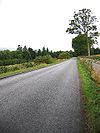
The route starts on the B934 adjacent to Forteviot Bridge over the River Earn; indeed there is a TOTSO here and so traffic crossing the river runs straight onto the B9112. The route then follows the Earn downstream, following a straighter route than the winding river, as it skirts the southern edge of the Dupplin Castle Estate. After climbing a little away from the riverbank, it drops gently down a long straight through fields before plunging into woodland. A windy section follows, which is soon climbing steeply out of the valley onto the hillside above. After levelling out, the route dips to cross the Milltown Burn as it passes through the small settlement of Milltown of Aberdalgie.
Continuing northeast, the route is climbing once more, along a fairly straight road across fields and through a wood, crossing a summit of over 120m. The steep, straight descent of Necessity Brae follows, set down in a shallow tree lined cutting. This takes the B9112 under the M90 and is a realignment from when the motorway was built. Necessity Brae continues downhill into Perth, passing a few houses and a golf course. The B9112 now bears left to end at a mini-roundabout on the A93 (former A9) in the Cherrybank area of Perth but originally followed the narrow Low Road to end closer to the town centre.
History
For a brief period in the 1980s (mapping evidence suggests c1982-c1990) the B9112 was extended, via a multiplex into the city centre. The A roads in and around Perth were being changed quite a bit at the time - first the A90 was renumbered as the A912 with the opening of the M90, then the A912 was extended north when the A9 western bypass was completed, while the A93 was extended west. Finally, the city centre ring was renumbered as the A989. Precise chronology is difficult to pin down, as different maps were updated at different times, but the earliest evidence so far for the B9112 in the city centre is an A-Z Atlas from 1982, while it is not shown on the 1983 OS Atlas. It has last been identified in 1988, and was no longer shown in 1996, although the precise date of its demise in this time window is not known.
The route of the city centre B9112 did not change during its brief life, and ran west to east along York Place, County Place and South Street before turning north along Tay Street. Tay Street is now once more part of the A85, while the rest of the route is now unclassified.
Outside of the city, the route is largely unchanged since it was first classified in the late 1920s. However, the descent of Necessity Brae to the motorway was built when the M90 was built. The old route survives at the top of the hill, heading north from the staggered crossroads across fields, and is still surfaced and used as a public path. It then turned east, and ran down hill along the field boundary, passing under the motorway embankment to rejoin its current alignment in the vicinity of the junction with Robb Place. This section has been removed completely.


