B3197
| B3197 | |||||||
| Location Map ( geo) | |||||||
| |||||||
| From: | Churchstow (SX704457) | ||||||
| To: | West Alvington (SX716434) | ||||||
| Distance: | 1.7 miles (2.7 km) | ||||||
| Met: | A379, A381 | ||||||
| Former Number(s): | B3209 | ||||||
| Now part of: | A381 | ||||||
| Traditional Counties | |||||||
| Route outline (key) | |||||||
| |||||||

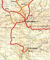
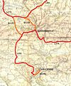
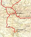
Thanks to Devon County Council's curious fiddling with its classified road network, the B3197 is a road which has come and gone a few times, although always remaining in much the same place. In its most recent incarnation, it connected the A379 at Churchstow with the A381 just SW of West Alvington, near Kingsbridge. This road has also held either the A379 or A381 number during one of the complex changes with the two roads crossing in this area. It now seems to be a spur of the latter.
As alluded to above, the B3197 hasn't always been that short, however. In 1922 the number was allocated to the entire route from Newton Abbot to Salcombe, with a short multiplex along the A385 in Totnes. Most of this was absorbed by the extension of the A381 in 1935, leaving the Kingsbridge to Salcombe section left. At the same time it took over the Churchstow to West Alvington road which prior to 1935 was the B3209; this became the mainline with the short stretch through West Alvington shown as a spur.
By 1961, the OS map shows the A381 finally reaching Salcombe, and the B3197 truncated to its most recent route. By 1974 even this section had gained Class I status but it lost it again in the 1990s with the changes in the Kingsbridge area and the B3197 was resurrected. In 2009 it was taken over again to become a spur of the A381, although there is no general consensus amongst current maps.


