B3128
| B3128 | |||||||
| Location Map ( geo) | |||||||
| |||||||
| From: | Long Ashton (ST559712) | ||||||
| To: | Tickenham (ST464718) | ||||||
| Distance: | 6.2 miles (10 km) | ||||||
| Meets: | A370, B3129, B3130 | ||||||
| Former Number(s): | B3342 | ||||||
| Old route now: | B3129 | ||||||
| Primary Destinations | |||||||
| Highway Authorities | |||||||
| Traditional Counties | |||||||
| Route outline (key) | |||||||
| |||||||
Route
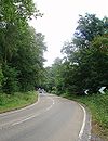
The B3128 is a rural B-road to the west of Bristol.
We start at the GSJ at the northern end of the Long Ashton Bypass (A370), just outside Bristol. The first junction is with the main road through Long Ashton itself, the former A370 no less, and then we are off up the hill and away on our journey west. We cross the B3129 at a crossroads and then skirt along the northern edge of the strange triangular village of Failand - perhaps the largest village on the route.
The road remains fairly fast, although there are several nasty junctions along it, made worse by the fact that we are right on the edge of the ridge in places, meaning joining traffic is doing a hill start! All too soon, however, we are descending once more and reach the B3130 at a fork junction just to the north of Nailsea. Most traffic will turn right and pass through Tickenham and so to Clevedon and the M5.
History
Originally the B3128 started on the B3124 (now A369) at Leigh Woods and headed south along what is now the B3129 as far as Failand to pick up its current route. The road east to Long Ashton was originally unclassified but quickly became the B3342. The 1935 renumberings brought about the road's current route.

