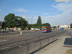
Henlys Corner
| Henlys Corner | |||
| Location Map ( geo) | |||
 | |||
| |||
| County | |||
| Middlesex | |||
| Highway Authority | |||
| Transport for London | |||
| Junction Type | |||
| Forks. Traffic Lights | |||
| Roads Joined | |||
| A1, A406, A598 | |||
Henlys Corner is situated at the interchange between the A1 / A406 North Circular Road and the A598 Regents Park Road / Finchley Road. It takes its name from the now defunct Henlys Garage once situated at the south-west side of the junction. Some people also include the two A1/A406 junctions situated a short distance east and west of the A598 as part of Henlys Corner.
History
At the time of the first world war, this part of north London was all but undeveloped, and the site of the junction was open countryside. The 1923 MOT map shows the A406 between Staples Corner and the A598 Regents Park Road as under construction, the final approach to the A598 being the present Charter Way. The 1926-28 MOT map shows this section complete, with the A406 to the east, the A1 Falloden Way and the A1 Great North Road shown as in the course of construction. According to the 1935 half inch map the present A1 Great North Road was then designated A5093. It can therefore be deduced that the junction opened in the late 1920s.
Large scale Ordnance Survey mapping from the mid 1930s suggests that whilst the A598 was broadly as it is now, the A406 was single carriageway. A search of on-line mapping suggests that the A406 wasn't dualled until the early 1970s, a layout that lasted until 2011.
As a trunk road, the junction was maintained by the Department for Transport and then the Highways Agency until the creation of Transport for London (TfL) in 1999.
The Tunnel Scheme
Plans to grade separate the A1-A598-A1 junction complex date back to the 1960s. The first real proposals were made in 1979 where four options for various lengths of tunnels were put to consultation. An exhibition was held at a local church at the start of that year. The third design was believed to be the preferred option.
Nothing else happened until the late 1980s and early 1990s, when as part of a wider upgrade to the A406, the Department for Transport developed a scheme to grade separate Henlys Corner by constructing a cut and cover tunnel in the park land to the south of the A406. The tunnel would have carried A406 traffic under the existing junction which would have served the A1 and A598. Slip roads would have linked the buried A406 to the above ground junction. It is not known at the current time if this is based on any of the 1979 designs or whether the scheme was developed from scratch.
Whilst some preliminary works were carried out to divert services, and land was obtained, the scheme itself was shelved in the early 1990s.
The 2011 Improvement
Henlys Corner experienced increasing congestion over many years, and as such TfL developed a scheme to provide improved capacity and pedestrian crossing facilities at the junction. The A406 was widened to provide 4 lanes in each direction between the two A1 junctions. Right turning vehicles from the A406 and A1 westbound into the A598 Regents Park Road now turn via a half-hamburger arrangement creating a displaced right turn. This removes right turning traffic from the middle of the junction, increasing vehicle capacity at the junction. The scheme was substantially complete at the end of December 2011.
Pedestrian Crossings
Prior to 2011 there had never been signalised pedestrian crossings at Henlys Corner. As the junction is located close to one of the largest Synagogues in London, the inclusion of hands free pedestrian crossings was widely reported in the media. Newspaper report.
Routes
| Route | To | Notes |
| The NORTH, Watford, Mill Hill, Hendon, (M1) | ||
| Central London, Holloway | ||
| North Circular (A41, A40), Brent Cross | ||
| N.Circular (A10, M11), Wood Green | ||
| Finchley | ||
| Walthamstow, Finsbury Park |


