A1/Central London - South Mimms
| A1 | |||||||||||||||||||||||||||||||||||||||||||
| |||||||||||||||||||||||||||||||||||||||||||
| The Great North Road | |||||||||||||||||||||||||||||||||||||||||||
| From: | City of London (TQ321812) | ||||||||||||||||||||||||||||||||||||||||||
| To: | South Mimms (TL225001) | ||||||||||||||||||||||||||||||||||||||||||
| Distance: | 16 miles (25.7 km) | ||||||||||||||||||||||||||||||||||||||||||
| Meets: | M1, M25, A1(M), A40, A41, A406, A501 | ||||||||||||||||||||||||||||||||||||||||||
| Former Number(s): | A555 | ||||||||||||||||||||||||||||||||||||||||||
| Old route now: | A1000 | ||||||||||||||||||||||||||||||||||||||||||
| Primary Destinations | |||||||||||||||||||||||||||||||||||||||||||
| Highway Authorities | |||||||||||||||||||||||||||||||||||||||||||
National Highways • Transport for London • City of London • Islington Council | |||||||||||||||||||||||||||||||||||||||||||
| Counties | |||||||||||||||||||||||||||||||||||||||||||
Hertfordshire • Middlesex | |||||||||||||||||||||||||||||||||||||||||||
| Route outline (key) | |||||||||||||||||||||||||||||||||||||||||||
| |||||||||||||||||||||||||||||||||||||||||||
| Junction List | |||||||||||||||||||||||||||||||||||||||||||
| |||||||||||||||||||||||||||||||||||||||||||
Route
Although there is some evidence (covered below) that the A1 originally began at St Paul's Cathedral, perhaps even at the Bank of England, the route today begins at a central London roundabout underneath the Museum of London at the junction with the A1211 London Wall which leads to Tower Bridge and a gyratory that links the A1 to the A40 leading to western London. The beginning the route north towards Edinburgh follows a number of dual carriageway city streets, passing the Barbican and the ring of steel gateway into the city on the southbound carriageway. Beyond, the roadside street scene becomes very much like any other town or city, reducing to a wide single carriageway before crossing the A5201 at a typically capital style signal-controlled junction.
Following Goswell Road through an increasingly urban residential area, the route reaches a gyratory system in Finsbury, where it becomes primary in status and shares a route number with the A501, which connects to western London, the A40, and ultimately the M40 and the rest of the motorway network. The route turns sharply through 90 degrees at the crossroads with the A401 back onto a northerly heading, and leaves the congestion zone boundary. Here the A1 becomes and remains a key national route all the way to Edinburgh. Following Upper Street along a wide dual carriageway through a busy shopping area, past the A104 and onwards through Islington, the road is littered with zebra crossings through to Highbury, where a roundabout connects the A1 to the A1201 and A1200 directly above the Channel Tunnel Rail Link (CTRL).
Picking up Holloway Road, which is at first a wide single carriageway with bus lanes each side, the route passes the A103 next to the London Metropolitan University (North Campus). It passes the Emirates Stadium, home to Arsenal Football Club, and crosses the A503 near to HM Prison Holloway, where the route widens out to a shop-fronted dual carriageway. Beyond, the A1 resumes a predominantly residential feel, the frontage comprising a mix of houses, shops with flats above, and the occasional office, until reaching Upper Holloway, where it meets a busy junction with the A400 and B519. Archway Road carries the A1 as a well engineered but old dual carriageway onto the hill that plays host to Highgate, passing under the landmark arch that carries the B540 Honsey Lane. The bridge was constructed in 1900, replacing a smaller structure built by Thomas Telford. Highgate is not dissimilar from the route so far, but it is made more suburban, with trees lining much of the road.
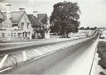
A few miles north, the Great North Road and the A1 part company. The A1 follows a new alignment began in the late 1920s, which takes the route several miles to the west, avoiding the then developing areas of Finchley and Barnet, through what was to become the later developed area of Hendon. This leaves the Great North Road to follow the A1000. Between the A1000 and A406 (North Circular), the A1 assumes a much grander form, with wide verges along most of the length, a mix of dual and single carriageway, service roads, and large spacious junctions. After a short multiplex with the A406, where wide areas appear to have been set aside for later widening, the A1 crosses the A598 and heads north again, skirting the northern edge of Hendon with a grand and reasonably well engineered route for the time (circa 1930), making access to the new suburban areas easier for residents with motor cars. The dual carriageway continues all the way to Morpeth from here, crossing the A504, before a key junction with the M1 and the A41, at a roundabout with a flyover between the M1 and A1, which for 10 years was the southern terminus of the M1, until it was extended south in 1977.
To be continued....
History
A series of bypasses where constructed through the 1950s and 1960s around the new suburban commuter areas of Middlesex and several market towns in the Midlands. These schemes massively reduced travel times on the Great North Road and provided vital relief for traffic-choked towns.


