A732
| A732 | ||||
| Location Map ( geo) | ||||
| ||||
| From: | Gorbals Cross (NS585644) | |||
| To: | Mount Vernon (NS663628) | |||
| Distance: | 5.3 miles (8.5 km) | |||
| Met (1922): | A8, A77, A728, A731, A74, A721 | |||
| Now part of: | A74 | |||
| Traditional Counties | ||||
| Route outline (key) | ||||
| ||||
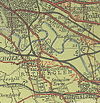
The A732 was a short lived route in Glasgow's East End.
Route
The route started on the A8 at Gorbals Cross just across the Clyde from the city centre, and headed east along Ballater Street, crossing the A728 on Crown Street. It crossed the river on Kings Bridge and then crossed Glasgow Green on Kings Drive before entering the Bridgeton District as James Street. At Bridgeton Cross, the A732 crossed the A74 and ran along London Road as it slowly worked its way out of the growing city to end on the A721 at Mount Vernon.
The whole route was renumbered in 1936, the western end as far as Bridgeton Cross becoming an extension of the A737, while the eastern end along London Road was renumbered as the A74, the former A74 route being renumbered as the A724 and A749. The A732 number has not been reused since.
An official document from 16/05/1936 details the following changes:
Re-numbered as follows:- (a) From junction Norfolk Street (A8) and Main Street (A77) via Ballater Street, King's Bridge, King's Drive and James Street to Bridgeton Cross re-numbered as A737. (b) From Bridgeton Cross via London Road to Mount Vernon Station (Junction A721) re-numbered as A74.


