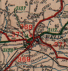
A369
| A369 | ||||
| Location Map ( geo) | ||||
| ||||
| From: | Bristol (ST565715) | |||
| To: | Portishead (ST470768) | |||
| Distance: | 8 miles (12.9 km) | |||
| Meets: | A370, A3029, B3129, M5, B3124 | |||
| Former Number(s): | B3126, B3124 | |||
| Primary Destinations | ||||
| Highway Authorities | ||||
| Traditional Counties | ||||
| Route outline (key) | ||||
| ||||
For the original A369, a road between Glastonbury and Marksbury near Bath, see A369 (Glastonbury - Marksbury).
Route
The A369 is a remarkably rural A-road in north Somerset.
Ashton Gate – Portishead
The road starts at the Ashton Gate junction with the A370 and the A3029 to the south west of Bristol city centre. The first part is relatively flat, with the Ashton Court Estate on the left hand side and sports grounds to the right. Soon, however, the river Avon appears on the right with the Cumberland Basin also briefly in view. Then the quite tricky 1 in 7 uphill gradient of Rownham Hill presents itself to drivers, and a twisty residential road (with expensive houses!) up to the Clifton Suspension Bridge is accessed on the right at quite a nasty junction. Then the road levels out slightly but continues to climb until a traffic-light junction at the entrance to Ashton Court Estate appears on the left, and the B3129 from the Suspension Bridge merges from the right. A bit further on after the road dips there are some more traffic lights at the junction where the B3129 goes left running along the northern edge of Ashton Court Estate towards Failand.
From here the A369 continues – a 40 mph speed limit applies along this stretch with Abbots Leigh off to the right. The roads dips down gradually and the speed limit increases to 50 mph. The road to Pill and Ham Green hospital appears on the right and the main road dips sharply down Haberfield Hill to cross a small stream and then climbs just as sharply again on the other side. After a while the road for Easton-in-Gordano runs off to the right and the A369 drops downhill slowly to meet Portbury Lane on the left (which was the A369 before the M5 was built) as the main road sweeps round to arrive at junction 19 of the M5, providing access for Avonmouth docks and the Gordano service area.
From here on, the A369 is almost all new build, initially bending sharply left and then running along a quite straight and fast stretch called The Portbury Hundred (a name taken from one of King Harold's private estates). The road to Sheepway is on the right just after a footbridge crossing both the A369 and the M5 giving access to the village of Portbury. (Before the M5 was constructed this used to be the old route of the main road.)
A bit further on the A369 reaches the outskirts of Portishead and at a roundabout the B3124 exits left towards Clevedon, and the road from Sheepway enters from the right. After another roundabout a few hundred yards on, the road enters a short dual carriageway with another left turn onto the B3124 High Street, as well as a junction for Cabstand which leads to Nore Road (offering views over the Bristol Channel to the right). After TOTSOing left at the end of the dual carriageway, the A369 terminates by Portishead Primary School where Station Road becomes the unclassified Lower Burlington Road.
History
Back in 1922 the A369 was a road from Ashcott to Marksbury in the middle of the county. However, by 1935 this became part of an extended A39, and so the A369 number lay dormant for many years.
By the 1950s it was felt that Portishead was due a connection to the A-road network and so what had been the B3124 was upgraded to become the A369. That road went over the Clifton Suspension Bridge, however, so the A369 was instead routed over the B3126 to meet the A370.
In 1972, the M5 was opened from the Avonmouth Bridge southwards, and so the western half of the A369 was upgraded and improved to connect into the new Gordano Interchange. Portbury to Sheepway was severed by the M5 so a link from the motorway junction to Sheepway was constructed on the north side of the motorway. The new link westwards to Wyndham Way, Portishead was opened in 1974.
Once Portishead itself is reached, the old route followed the two arms of the B3124, but this was no longer a suitable route for a growing dormitory suburb of Bristol, so Wyndham Way was constructed and opened in 1970 to allow faster access to the Town, the Docks and the Power Station.


