Star.pngStar.pngStar.pngStar.pngStar grey.png

B7054 (Greenock Centre)

From Roader's Digest: The SABRE Wiki
Jump to navigation Jump to search
B7054
Location Map ( geo)
Cameraicon.png View gallery (8)
From:  Grey Place (NS275767)
To:  High Street (NS283760)
Via:  West Blackhall Street, Cathcart Street
Distance:  1.5 miles (2.4 km)
Met (1970) A8, A742, A8
Traditional Counties

Renfrewshire

Route outline (key)
B7054 Link in Greenock
This article is about the former B7054 in central Greenock.
For the current B7054 to the south of Greenock, see B7054
.


West Blackhall Street (on the former route of the B7054)

The original line of the B7054 was much closer in to Greenock town centre than the current route, and the route varied a little over the years. Identified, but unnumbered on old one-inch maps, it is now known from larger-scale mapping that the B7054 previously ran along West Blackhall Street, parallel to what is now the A770 in central Greenock. Originally it appears that the A742, as was, then followed Cathcart Street to meet the A8 Rue End Street. Later, however – when the A742 was re-routed to roughly the current line of the A78 – it crossed the B7054, which was also extended eastwards along Cathcart Street, making it a loop off the A8.

The Oak Mall, looking west along the former route of the B7054

Today, the whole area around this route has been heavily rebuilt twice since the early 1970s, firstly with Greenock's new shopping precinct obliterating the central section of the old road, then twenty years later this precinct was extended and roofed. What is left is West Blackhall Street and Cathcart Street (both now unclassified), but there is no road between the two except the current line of the A78, which runs at right angles to meet the A8.


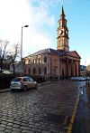
B7054 (Greenock Centre)
Related Pictures
View gallery (8)
Cathcart Street - Geograph - 6697193.jpgCathcart Square - Geograph - 1088536.jpgGreenock Mid Kirk - Geograph - 3811990.jpgCathcart Street - Geograph - 3715305.jpgAustin Gipsy fire appliance in the Oak Mall - Geograph - 5702096.jpg
Other nearby roads
Greenock
B7000 – B7999
B7000 • B7001 • B7002 • B7003 • B7004 • B7005 • B7006 • B7007 • B7008 • B7009 • B7010 • B7011 • B7012 • B7013 • B7014 • B7015 • B7016 • B7017 • B7018 • B7019
B7020 • B7021 • B7022 • B7023 • B7024 • B7025 • B7026 • B7027 • B7028 • B7029 • B7030 • B7031 • B7032 • B7033 • B7034 • B7035 • B7036 • B7037 • B7038 • B7039
B7040 • B7041 • B7042 • B7043 • B7044 • B7045 • B7046 • B7047 • B7048 • B7049 • B7050 • B7051 • B7052 • B7053 • B7054 • B7055 • B7056 • B7057 • B7058 • B7059
B7060 • B7061 • B7062 • B7063 • B7064 • B7065 • B7066 • B7067 • B7068 • B7069 • B7070 • B7071 • B7072 • B7073 • B7074 • B7075 • B7076 • B7077 • B7078 • B7079
B7080 • B7081 • B7082 • B7083 • B7084 • B7085 • B7086 • B7087 • B7088 • B7089 • B7090 • B7091 • B7092 • B7093 • B7094 • B7095 • B7096 • B7097 • B7098 • B7099
B7201
Earlier iterations: B7000 • B7011 • B7035 • B7039 • B7054 • B7058

SABRE - The Society for All British and Irish Road Enthusiasts
Discuss - Digest - Discover - Help