Star.pngStar.pngStar grey.pngStar grey.pngStar grey.png

B4171

From Roader's Digest: The SABRE Wiki
Jump to navigation Jump to search
B4171
Location Map ( geo)
Cameraicon.png View gallery (2)
From:  Dudley (SO948906)
To:  Blackheath (SO974865)
Via:  Rowley Regis
Distance:  3.3 miles (5.3 km)
Meets:  A459, A4100
Former Number(s):  A461
Old route now:  A4099
Primary Destinations
Highway Authorities

Dudley  • Sandwell

Traditional Counties

Staffordshire • Worcestershire

Route outline (key)
B4171 Dudley - Blackheath
B4171 Blackheath - Halesowen

The B4171 is an urban B-road running through the Black Country.

Route

The B4171 passing Blackheath Church

Starting at traffic lights on the A459 the road heads south alongside the old railway line along an intermittently dual road along the edge of Dudley town centre. It turns left at traffic lights onto Hall Street and goes over the A461 before continuing on into Kate's Hill.

After a mini-roundabout the road TOTSOs left then descends steeply to cross a small wooded valley. We go over the Netherton Canal Tunnel at this point but there's no sign of this. The road then runs through Springfield and Rowley Regis and skirts the southern edge of Turner's Hill (the hill with the mast that's clearly visible from the M5). After passing a golf course the road continues along Birmingham Road into Blackheath town centre, ending at a roundabout on the A4100 relief road.

History

In 1922, the B4171 followed its current route from Dudley into Blackheath Town Centre, meeting the A4034, before turning down Halesowen Street and following the present route of the A4099 to meet the A459 north of Halesowen. The upgrade to A4099 took place in April 1925.

The B4177 gained a short extension at the northern end in the late 1990s. Due to the opening of the A461 Dudley Southern Bypass, the former section of the A461 along Trindle Road to the site of the closed Dudley railway station became part of the B4177.


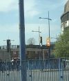

B4171
Places
Related Pictures
View gallery (2)
Blackheath Church - Geograph - 393166.jpgIMG 0314.JPG dudley street lights.jpg
Other nearby roads
Dudley
A457 • A459 • A461 • A4033 • A4036 • A4037 • A4100 • A4101 • A4123 • A4168 • B4158 (Dudley) • B4172 • B4173 • B4174 • B4175 • B4176 • B4177 • B4177 (Dudley - Kingswinford) • B4178 • B4179 • B4180 • B4458 (Dudley) • B4483 • B4517 • B4558 (Dudley) • B4563 • B4587 (Dudley) • B4588 • Dudley Tour • T14 (Britain) • Western Orbital
Halesowen
A456 • A458 • A459 • A4034 • A4099 • B4043 • B4096 • B4174 • B4183 • B4551
B4100 – B4199
B4100(N) • B4100(S) • B4101 • B4102 • B4103 • B4104(N) • B4104(S) • B4105(E) • B4105(W) • B4106 • B4107 • B4108 • B4109 • B4110 • B4111 • B4112 • B4113 • B4114 • B4115 • B4116 • B4117 • B4118(W) • B4118(E) • B4119
B4120 • B4121 • B4122(N) • B4122(S) • B4123 • B4124 • B4125 • B4126 • B4127 • B4128 • B4129 • B4130 • B4131 • B4132 • B4133 • B4134 • B4135 • B4136 • B4137 • B4138 • B4139
B4140 • B4141 • B4142 • B4143 • B4144 • B4145 • B4146 • B4147 • B4148 • B4149 • B4150 • B4151 • B4152 • B4153 • B4154 • B4155 • B4156 • B4157 • B4158 • B4159
B4160 • B4161 • B4162 • B4163 • B4164 • B4165 • B4166 • B4167 • B4168 • B4169 • B4170 • B4171 • B4172 • B4173 • B4174 • B4175 • B4176 • B4177 • B4178 • B4179
B4180 • B4181 • B4182 • B4183 • B4184 • B4185 • B4186 • B4187 • B4188 • B4189 • B4190 • B4191 • B4192 • B4193 • B4194 • B4195 • B4196 • B4197 • B4198 • B4199
Earlier usesB4100 • B4105 • B4107 • B4111 • B4113 • B4115 • B4119 • B4128 • B4129 • B4139 • B4141 • B4143
B4150 • B4158(N) • B4158(S) • B4160 • B4162 • B4164 • B4177 • B4181 • B4184 • B4186 • B4192 • B4197


SABRE - The Society for All British and Irish Road Enthusiasts
Discuss - Digest - Discover - Help