Star.pngStar.pngStar grey.pngStar grey.pngStar grey.png

B4118 (Birmingham)

From Roader's Digest: The SABRE Wiki
Jump to navigation Jump to search
B4118
Location Map ( geo)
Cameraicon.png View gallery (3)
From:  Castle Bromwich (SP144895)
To:  Water Orton (SP187917)
Distance:  3.5 miles (5.6 km)
Meets:  B4114, B4119, B4117, A446
Former Number(s):  A47
Highway Authorities

Birmingham • Solihull • Warwickshire

Traditional Counties

Warwickshire

Route outline (key)
B4118 Castle Bromwich - Water Orton
This article is about the B4118 to the east of Birmingham.
For the version located in Coventry, see B4118 (Coventry)
.
The split between the B4118 and B4119

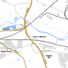
The B4118 runs parallel to the M6 to the east of Birmingham.

It starts at the B4114 Bradford Road in Castle Bromwich and heads in a generally eastwards direction. Initially it goes north along Hall Road before turning right at a mini roundabout by Castle Bromwich Hall. It then follows Chester Road before reaching a fork with the B4119. It now heads northeast along a wide, tree-lined avenue before crossing the A452 and M6 on the same bridge.

After crossing a small corner of Birmingham Council's area the road enters Water Orton. Here there is a junction with the B4117 and the B4118 has to TOTSO left. It crosses the Birmingham to Nuneaton railway line by Water Orton station before turning eastwards. After passing a pool it goes under the M42/M6 Toll before ending immediately afterwards at traffic lights on the A446.



B4118 (Birmingham)
Related Pictures
View gallery (3)
In Castle Bromwich - Geograph - 14509.jpgWater Orton, Warwickshire - Coppermine - 2146.JPGA446 Water Orton dualling.png
Other nearby roads
Birmingham
A34 • A38 • A38(M) • A41 • A42 (Reading - Birmingham) • A45 • A47 • A435 • A441 • A452 • A453 • A455 (Birmingham - Stafford) • A456 • A457 • A458 • A4027 • A4028 • A4029 • A4030 • A4040 • A4097 • A4123 • A4166 • A4167 • A4400 • A4540 • A4723 • A5127 • B38 (Selly Oak) • B384 • B3800 • B4025 • B4043 • B4096 • B4100 (Birmingham) • B4114 • B4120 • B4121 • B4122 (Birmingham) • B4123 • B4124 • B4125 • B4126 • B4127 • B4128 • B4128 (Suffolk Street, Birmingham) • B4129 • B4129 (Birmingham City Centre) • B4130 • B4131 • B4132 • B4133 • B4134 • B4135 • B4136 • B4137 • B4140 • B4141 (Birmingham) • B4142 • B4143 (Birmingham) • B4144 • B4145 • B4146 • B4147 • B4148 • B4167 • B4182 • B4217 • B4284 • B4498 • B4514 • B4515 • B4516 • B4531 • B4532 • B4533 • B4552 • B4730 • E05 • E24 • E28 (Birmingham - Ipswich) • E33 (London - Glasgow) • E116 (Old System) • Holyhead Road • Longest Lane • M5 • M6 • M40 • M42 • M600 • Northern and Western Motorway • Ryknild Street • T13 (Britain) • T14 (Britain) • T15 (Britain) • T16 (Britain) • T35 (Britain) • T53 (Britain)
B4100 – B4199
B4100(N) • B4100(S) • B4101 • B4102 • B4103 • B4104(N) • B4104(S) • B4105(E) • B4105(W) • B4106 • B4107 • B4108 • B4109 • B4110 • B4111 • B4112 • B4113 • B4114 • B4115 • B4116 • B4117 • B4118(W) • B4118(E) • B4119
B4120 • B4121 • B4122(N) • B4122(S) • B4123 • B4124 • B4125 • B4126 • B4127 • B4128 • B4129 • B4130 • B4131 • B4132 • B4133 • B4134 • B4135 • B4136 • B4137 • B4138 • B4139
B4140 • B4141 • B4142 • B4143 • B4144 • B4145 • B4146 • B4147 • B4148 • B4149 • B4150 • B4151 • B4152 • B4153 • B4154 • B4155 • B4156 • B4157 • B4158 • B4159
B4160 • B4161 • B4162 • B4163 • B4164 • B4165 • B4166 • B4167 • B4168 • B4169 • B4170 • B4171 • B4172 • B4173 • B4174 • B4175 • B4176 • B4177 • B4178 • B4179
B4180 • B4181 • B4182 • B4183 • B4184 • B4185 • B4186 • B4187 • B4188 • B4189 • B4190 • B4191 • B4192 • B4193 • B4194 • B4195 • B4196 • B4197 • B4198 • B4199
Earlier usesB4100 • B4105 • B4107 • B4111 • B4113 • B4115 • B4119 • B4128 • B4129 • B4139 • B4141 • B4143
B4150 • B4158(N) • B4158(S) • B4160 • B4162 • B4164 • B4177 • B4181 • B4184 • B4186 • B4192 • B4197


SABRE - The Society for All British and Irish Road Enthusiasts
Discuss - Digest - Discover - Help