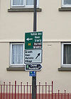
A8 (Jersey)
| A8 | ||||
| Location Map ( geo) | ||||
| ||||
| From: | St Helier (XD921797) | |||
| To: | Hautes Croix (XD919734) | |||
| Via: | Trinity | |||
| Distance: | 5.4 miles (8.7 km) | |||
| Meets: | B76, A14, A9 | |||
| Highway Authorities | ||||
| Traditional Counties | ||||
| Route outline (key) | ||||
| ||||
For the Scottish A8, see A8.
For the Northern Irish A8, see A8 (Northern Ireland).
For the Manx A8, see A8 (Isle of Man).
Some maps show different start points for the Jersey A8, with some showing the road continuing all the way to meet the Esplanade, while others show it only beginning at the Ring Road. Road signage indicates the whole road is the A8, however signage is sparse south of Burrard St due to a Precinct system preventing through traffic.
The A8 currently starts at a signalised junction with the B76 to the north of the town centre of St Helier. However, it can be assumed that it previously continued south along New Street, and then Conway Street to meet the Esplanade. Heading north, New Street, later Val Plaisant is currently one-way into the town at first, but opposite St Thomas's Church, the B74 joins from the right, and the A8 becomes two way, heading out of town. The A14, ring road is crossed via a small signalised gyratory (featuring a filter in turn), and then the A8 climbs up the steep Trinity Hill, winding past a Waitrose Store, beyond which there are fields on the left.
The A8 is now following La Route de la Trinité, and quickly leaves the St Helier urban area behind, however the urban speed limit maintains throughout the rural section of the parish, up to the border with Trinity at Oaklands.
The road runs through the rural parish of Trinity, including the small settlement of Les Ifs (featuring a petrol station and car sales garage), preserve of Jersey Cows and Jersey Royals. It is increasingly difficult to see this from the A8 however, as roadside development slowly hides the fields from view. The scattered village of Trinity is finally reached, home to the Royal Jersey Showground, a pub and small shop. In the centre of the village, the A8 doglegs around Trinity Church, with a double TOTSO, first with the B51, then the B31. A third TOTSO, with the C96, sees the route turn west and leave the village behind.
The last stretch of the A8 is unusual, in being an A road section of the main north coast road, the rest of the route being B roads, apart from the A9 which we shall meet soon. This section of the route is perhaps the prettiest, often running through a quite narrow tree-lined avenue, with high hedges and walls hiding some grand houses. All too soon, however, Hautes Croix is reached, a staggered crossroads where the A8 turns left to meet the A9, which continues west across the north of the island.
An image has been requested for this article.
