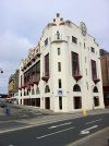
A8 (Isle of Man)
| A8 | ||||
| Location Map ( geo) | ||||
| ||||
| From: | Douglas Sea Terminal (SC383754) | |||
| To: | Douglas Railway Station (SC377752) | |||
| Via: | North Quay | |||
| Distance: | 0.5 miles (0.8 km) | |||
| Meets: | A11, B73, A1, A44, B69, A33 | |||
| Primary Destinations | ||||
| Highway Authorities | ||||
| Traditional Counties | ||||
| Route outline (key) | ||||
| ||||
For the former A8 on the Isle of Man, between Ballasalla and Castletown, see A8 (Ballasalla - Castletown).
The A8 is a short road along the north bank of the River Douglas. Much of the route has been traffic calmed.
Route
Beginning at a roundabout at the Sea Terminal, where the A11 also begins, the A8 heads south. After another roundabout at the Sea Terminal, this time with the entrance to the ferry port, there is a roundabout with the A1 and then another (Double Corner) with the Douglas Harbour Lifting Bridge.
At Double Corner, the main bit of the route is over, after just 200 yards (220m), but 4 roundabouts. However, the designation still exists along North Quay, which has been heavily traffic calmed to distract through traffic. Most of North Quay is a one-way road with one narrow lane (sometimes with parking spaces alongside) and no kerb separating the road from the pavement: just different surfacing. Running along Douglas Inner Harbour's north side, it is made of three one way loops, with traffic running eastbound between Double Corner and Ridgeway Street and between Quines Corner and Bridge Street, but westbound between Ridgeway Street and Quines Corner. The section between Quines Corner and Bridge Street is not a 'Paved Street', but like the rest of North Quay, forms part of a 20mph zone.


