B5159
| B5159 | ||||
| Location Map ( geo) | ||||
| ||||
| From: | High Legh (SJ698837) | |||
| To: | Warburton (Toll road) (SJ698895) | |||
| Distance: | 4 miles (6.4 km) | |||
| Meets: | A50, A56, A6144, unclassified | |||
| Highway Authorities | ||||
| Traditional Counties | ||||
| Route outline (key) | ||||
| ||||
The B5159 is a largely rural B-road in north Cheshire.
It starts on the A50 on the southern edge of the village of High Legh. The road has two branches, either side of the village hall; the eastern branch has to TOTSO.
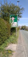
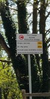
The road then heads north through the village and into open country. It crosses a bridge over the M56 and then enters Broomedge, where it crosses the A56 at traffic lights. A mile further north it reaches the Bridgewater Canal. The road turns left to run parallel for a short while whilst descending and then turns sharply right to go under the canal at a low, narrow bridge controlled by traffic lights. The traffic lights also control the flow at a crossroads on the far side of the canal.
The road then continues north through the fields. It crosses the Transpennine Trail before reaching a T-junction on the A6144 (former B5158) in Heatley. There is a short multiplex north across the River Bollin before the road turns left and regains its number. It is signposted as Irlam via toll bridge.
The B5159 heads north into the village of Warburton. After going through the centre of the village the road gains a 10mph speed limit before reaching a toll barrier. The B5159 ends here as it always has done. The road, however, continues on across the toll bridge (over the original course of the River Mersey - now just a ditch) before crossing the adjacent (and free) bridge over the Manchester Ship Canal to end at traffic lights on the A57.


