B6346
| B6346 | ||||
| Location Map ( geo) | ||||
| ||||
| From: | Wooperton (NU047201) | |||
| To: | Alnwick (NU194127) | |||
| Distance: | 11.8 miles (19 km) | |||
| Meets: | A697, B6347, B6341, B1340, A1068 | |||
| Former Number(s): | A1 | |||
| Primary Destinations | ||||
| Highway Authorities | ||||
| Traditional Counties | ||||
| Route outline (key) | ||||
| ||||
The B6346 is a cross-country B-road in north Northumberland.
The road starts on the A697 at Wooperton, on the edge of the Northumberland hills and heads northeast. It soon bends to the right to head eastwards along a straight road to cross the River Breamish and reach a T-junction. The road TOTSOs right here and continues eastwards, soon climbing out of the valley it has run through so far.
After crossing a ridge the road reaches the village of Eglingham. It descends to cross the Eglingham Burn and then continues along the side of the valley, never climbing particularly high even when it does move away from the burn. Eventually the B6347 turns off to the left, after which the road passes between two hills. There is now a high wall on the right; this marks the boundary of Hulne Park, part of the Alnwick Castle Estate. Indeed, the road continues to skirt the edge of the park as far as Alnwick itself.
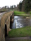
The River Aln is crossed, after which the road enters the town and reaches a T-junction by the castle. Originally this was the end of the B6346 on the original line of the A1. Now the B6341 heads left from here and the B6346 TOTSOs right to run along narrow roads into the Market Place where there is another T-junction. Our road TOTSOs left to run along Bondgate. It meets the B1340 by the Percy Tenantry Column and then continues past the infirmary to reach a roundabout on the A1068. The B6346 ends here and the road to the right is the continuation of the pre-bypass A1.

