B6361
| B6361 | |||||||
| Location Map ( geo) | |||||||
| |||||||
| From: | Melrose (NT567341) | ||||||
| To: | Newstead (NT547339) | ||||||
| Distance: | 1.6 miles (2.6 km) | ||||||
| Meets: | B6374, B6359, A6091 | ||||||
| Former Number(s): | B6359 | ||||||
| Primary Destinations | |||||||
| Highway Authorities | |||||||
| Traditional Counties | |||||||
| Route outline (key) | |||||||
| |||||||
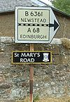
The B6361 is a short B-road which runs to the east of the Roxburghshire town of Melrose.
The route starts as part of the one-way system in Melrose town centre, forming two sides, while the B6374 forms the third. Outbound traffic starts on the B6374 (former A6091) towards the western end of the High Street and heads east along Buccleuch Street. This street runs straight into the inbound route, Abbey Street, which ends at a roundabout back on the B6374 and the B6359; indeed, this part of Abbey Street was the original northern end of the B6359. This all means that eastbound traffic on the B6374 has to use part of the B6361. Additionally, B6361 traffic has to TOTSO at the junction on Abbey Street when following the route. Abbey Street is a narrow (then very narrow) road past the abbey itself, with a short section giving priority to outbound traffic between the Abbey Precinct wall and a house. The road then widens and passes a few more scattered houses as it continues north onto Annay Road.
Annay Road is soon crossing fields, bending sharply to the right at a junction, where the minor road leads to a pedestrian footbridge over the River Tweed to Gattonside. The B6361 then runs east along a couple of short straights before a windier section climbs slightly into Newstead. The route runs east along Main Street, which soon becomes very narrow as it squeezes between old stone houses. It is climbing again as well, traffic having to navigate around parked cars, buildings jutting into the road and other traffic as it passes through this pretty village. Towards the top of the climb, the road widens out and the white centre line reappears just before a turning heads off across fields to the site of Trimontium Roman Fort (now just arable fields). The route then curves round to the right to end at a T-junction on the A6091.
History
As noted above, the B6361 has assumed the northern end of the B6359 within the one-way system around Melrose's town centre. At the opposite end, a much more drastic change has occurred. The current terminal junction dates from the completion of the Melrose bypass, when the A6091 was diverted onto a more northerly line avoiding the climb over the eastern foothills of the Eildon Hills. Before that road was built, however, the B6361 left Newstead heading east along the road to the Roman fort, which is now closed to traffic. It curved across the fields and passed under the second southern arch of the Leaderfoot Viaduct before ending on the A68 at the southern end of Drygrange Bridge. The new bridge was built at a higher level in 1974, and this saw the B6361 slightly extended along the former A68 line, heading south and climbing up to meet the new main road. This end of the old route remains open, and is largely used for parking for the viewpoints and Roman Fort.


