B1340
| B1340 | ||||
| Location Map ( geo) | ||||
| ||||
| From: | Alnwick (NU190131) | |||
| To: | Bamburgh (NU181349) | |||
| Distance: | 17.9 miles (28.8 km) | |||
| Meets: | B6346, A1, B6347, B1339, B1341, B1342 | |||
| Primary Destinations | ||||
| Highway Authorities | ||||
| Traditional Counties | ||||
| Route outline (key) | ||||
| ||||
The B1340 is a rural B-road in north Northumberland and part of the Northumberland Coastal Route.
It starts on the B6346 (former A1) in Alnwick on the eastern edge of the town centre close to the Percy Tenantry Column. It heads north, passing the Alnwick Garden before crossing the River Aln. The current route of the A1 is met at a GSJ.
Continuing northeast, the B1340 goes through Rennington before crossing the East Coast Main Line then running parallel to it as far as Christon Bank. Here the B1340 meets the end of the B6347 and has to TOTSO right. There is another TOTSO, left this time, about a mile further on when the B1339 is met. The B1340 is now the closest classified road to the North Sea.
The B1340 seems to enjoy TOTSOs, as there is another one (where it turns right) a couple of miles north, although here the other road is unclassified. The B1340 now heads directly towards the coast, although as the landscape is fairly flat the sea cannot be seen at this time. The coastal village of Beadnell is bypassed and then the B1340 turns northwards to follow the coast closely. Only now does the sea come into view.
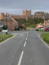
The road follows the coast for the rest of its route. It goes through the sand dunes to Seahouses before continuing through the sand into Bamburgh, with good views of the Farne Islands to the right. The B1340 passes below the castle before ending at a road feature that was common in 1922 but quite rare now: a triple point. The B1340 runs end-on onto the B1342 at the junction with the B1341.


