A42 (Isle of Man)
| A42 | ||||
| Location Map ( geo) | ||||
| ||||
| From: | Douglas (SC383754) | |||
| To: | Bray Hill (SC379770) | |||
| Distance: | 1.2 miles (1.9 km) | |||
| Meets: | A11, A44, A43, A45, A22 | |||
| Primary Destinations | ||||
| Highway Authorities | ||||
| Traditional Counties | ||||
| Route outline (key) | ||||
| ||||
The A42 is a short but busy route in central Douglas.
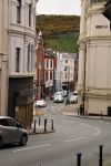
The route starts on the A11, Loch Promenade a little to the west of the Sea Terminal, and follows Victoria Street inland. The tall buildings on either side are largely occupied by offices, particularly banks and accountants, but the ground floors host a selection of restaurants and a few shops. There are a good mixture of fine old buildings and some very modern glass boxes! Duke Street, Douglas main shopping street is crossed, and then as the route starts to curve to the north, the A44, Ridgeway Street, comes in from the left. The first section of the A42 has all been one-way towards the shore, with the A44 providing the other part of the one-way system, in conjunction with the A1, Lord Street.
Now climbing Prospect Hill, the A42 is heading for the particularly ugly Victory House. The A43, Athol Street, comes in from the left opposite, and then as the route curves back to the north west, Tynwald appears ahead. This is the seat of the Isle of Man Government, reputedly the oldest sitting parliament in the world. The B64, Finch Road comes in from the right in front of Tynwald, and then the A42 climbs up past the government buildings. The A45, Circular Road, then turns left at a signalised junction, while the A42 curves right onto Bucks Road.
The town centre is now behind, and Bucks Road has much more of the feel of a suburban shopping street, although the larger than average number of cafes and restaurants is probably related to the proximity to Tynwald. The shops mostly line the right hand side of the route as it continues north, the pretty multicoloured terraces standing opposite, and lining the side streets, all interspersed with modern buildings, often blocks of flats. After a break in the shops, they resume on Woodbourne Road, which continues to wind northwards past small parks and churches stood amongst the terraced houses. Eventually, the houses drop from three to two storeys, and soon after the terraces give way to a more suburban environment of detached houses standing back in mature gardens.
Almost every other side street is a B road, but their density means that none are as busy as the unclassified through routes in most British cities. There are only a handful of detached properties, and then late Victorian Brick terraces resume, with some more modern infill. Before long, however, the route reaches its end at a T junction on the A22, Ballaquayle Road.


