Star.pngStar.pngStar.pngStar.pngStar grey.png

B13 (Ballanard - Sir Georges Bridge)

From Roader's Digest: The SABRE Wiki
Jump to navigation Jump to search
B13
Location Map ( geo)
Cameraicon.png View gallery (2)
From:  Ballanard (SC375778)
To:  Sir George's Bridge (SC364791)
Distance:  2 miles (3.2 km)
Met:  A2, B12, B14
Now part of:  A22
Primary Destinations
Traditional Counties

Isle of Man

Route outline (key)
B13 Ballanard - Sir George's Bridge
This article is about the original B13 on the Isle of Man.
For the current B13 near Jurby, see B13 (Isle of Man)
.
The A22 (former B13) north of Ballanard

The original B13 was a short route to the north of Douglas. It started on the A2 at Parkfield Corner and ran north along Ballanard Road to the crossroads at Willaston Corner, where it met the B12. Continuing ahead, the route passed through Ballanard itself and on to another crossroads where it turned left. It then dipped down to cross the River Glass at Sir George's Bridge, ending soon after at a T junction on the B14. The whole route was upgraded before 1963 to become the central part of the A22, a route which starts on Douglas Promenade and continues to Union Mills along part of the former B14.

The Manx Government Circular 1131 of 25/02/1926 defines this route as: Ballanard-road, Douglas, to Sir George’s Bridge, thence to Ballaoates


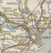


B13 (Ballanard - Sir Georges Bridge)
Places
Related Pictures
View gallery (2)
The A22 road north of Ballanard (C) Phil Catterall - Geograph - 482104.jpgIom-douglas-1926.jpg
Other nearby roads
Douglas
A1 (Isle of Man) • A2 (Isle of Man) • A5 (Isle of Man) • A6 (Isle of Man) • A8 (Isle of Man) • A11 (Isle of Man) • A18 (Isle of Man) • A21 (Isle of Man) • A22 (Isle of Man) • A23 (Isle of Man) • A24 (Isle of Man) • A25 (Isle of Man) • A33 (Isle of Man) • A37 (Isle of Man) • A38 (Isle of Man) • A41 (Isle of Man) • A42 (Isle of Man) • A43 (Isle of Man) • A44 (Isle of Man) • A45 (Isle of Man) • A46 (Isle of Man) • A47 (Isle of Man) • B11 (Governors Bridge - Ramsey) • B12 (Douglas - Cronk-ny-Mona) • B15 (Braddan Bridge - Injebreck) • B17 (Kewaigue - Foxdale) • B18 (Ellenbrook - Orrisdale) • B27 (Isle of Man) • B33 (Braddan) • B61 (Isle of Man) • B62 (Isle of Man) • B63 (Isle of Man) • B64 (Isle of Man) • B65 (Isle of Man) • B66 (Isle of Man) • B67 (Isle of Man) • B68 (Isle of Man) • B69 (Isle of Man) • B70 (Isle of Man) • B71 (Isle of Man) • B72 (Isle of Man) • B73 (Isle of Man) • B74 (Isle of Man) • B75 (Isle of Man) • B76 (Isle of Man) • B77 (Isle of Man) • B78 (Isle of Man) • B79 (Isle of Man) • B80 (Isle of Man) • B81 (Isle of Man) • B82 (Isle of Man) • Clypse Course • Marine Drive (Isle of Man) • TT Access Road • TT Circuit
B Roads on the Isle of Man
B1 · B2 · B3 · B4 · B5 · B6 · B7 · B8 · B9 · B10 · B11 · B12 · B13 · B14 · B15 · B16 · B17 · B18 · B19
B20 · B21 · B22 · B23 · B24 · B25 · B26 · B27 · B28 · B29 · B30 · B31 · B32 · B33 · B34 · B35 · B36 · B37 · B38 · B39
B40 · B41 · B42 · B43 · B44 · B45 · B46 · B47 · B48 · B49 · B50 · B51 · B52 · B53 · B54 · B55 · B56 · B57 · B58 · B59
B60 · B61 · B62 · B63 · B64 · B65 · B66 · B67 · B68 · B69 · B70 · B71 · B72 · B73 · B74 · B75 · B76 · B77 · B78 · B79
B80 · B81 · B82 · B83 · B84 · B85 · B86 · B87 · B88 · B89 · B90 · B91 · B92 · B93 · B94 · B95 · B96 · B97 · B98 · B99
Former numbers: B1 · B2 · B3 · B4 · B5 · B6 · B7 · B8 · B9 · B10 · B11 · B12 · B13 · B14 · B15 · B16 · B17 · B18 · B19
B20 · B21 · B22 · B23 · B24 · B25 · B26 · B27 · B28 · B29 · B30 · B31 · B32 (S) · B32 (N) · B33 · B34 · B35 · B36 · B37


SABRE - The Society for All British and Irish Road Enthusiasts
Discuss - Digest - Discover - Help