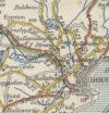
B11 (Governors Bridge - Ramsey)
Jump to navigation
Jump to search
| B11 | ||||
| Location Map ( geo) | ||||
| ||||
| From: | Douglas (SC389779) | |||
| To: | Ramsey (SC449943) | |||
| Via: | Snaefell | |||
| Distance: | 13.4 miles (21.6 km) | |||
| Met: | A2, B12, B10, A2 | |||
| Now part of: | A18 | |||
| Primary Destinations | ||||
| Traditional Counties | ||||
| Route outline (key) | ||||
| ||||
This article is about the original B11, now the A18 Mountain Road.
For the current B11 in Laxey, see B11 (Isle of Man).
For the current B11 in Laxey, see B11 (Isle of Man).
The original B11 is better known as the Mountain Road, and is now numbered as the A18. The route itself is little changed, starting at Governors Bridge in Douglas before climbing up to Bungalow junction below Snaefell. It then drops down a spectacular road to Ramsey. The route has been part of the TT Circuit longer than it has been classified, and as a result has seen more upgrades and improvements than many of the other roads on the island. Today it is the main road between Douglas and Ramsey, being quicker than the A2 along the coast, and it was possibly for this reason that it was renumbered as an A road before 1963.
The Manx Government Circular 1131 of 25/02/1926 defines this route as: Douglas, from Governor's Bridge and including Avondale-road Onchan, to Ramsey via Mountain-road
Links


