B6175
| B6175 | ||||||||||
| Location Map ( geo) | ||||||||||
| ||||||||||
| From: | Greenfield (SD991046) | |||||||||
| To: | Dukinfield (SJ949966) | |||||||||
| Via: | Buckton Vale, Stalybridge | |||||||||
| Distance: | 7.2 miles (11.6 km) | |||||||||
| Meets: | A669, A635, A6018, B6176, B6445, B6431, B6170 | |||||||||
| Old route now: | B6176 | |||||||||
| Highway Authorities | ||||||||||
| Traditional Counties | ||||||||||
| Route outline (key) | ||||||||||
| ||||||||||
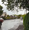
The B6175 follows the River Tame downstream from Greenfield.
The road starts on a hairpin bend on the A669 in Greenfield and heads west between the Manchester to Huddersfield railway line and the Huddersfield Narrow Canal before bending to the left and going over the canal and then the River Tame immediately afterwards, before crossing the A635.
The road skirts the edge of the valley, passing through Roaches before a brief rural section brings us to Micklehurst, on the eastern edge of Mossley. The road zigzags to cross a stream before continuing along largely residential roads (although it does pass a golf course) to reach traffic lights on the A6018 on the eastern edge of Stalybridge.
Originally the B6175 multiplexed west along the A6018, crossing the canal and river again, before regaining its number to head along Market Street. It met the B6176 and turned left to go along Caroline Street, recrossing the waterways to get to Albert Square. Now, however, the B6175 multiplexes east along the A6018 to reappear by turning right at the next set of traffic lights. It goes west to rejoin its original route at traffic lights. It is notable that Market Street has now become an extension of the B6176, emphasising that this is no longer the through route, whilst Caroline Street is still numbered B6175, although it is now a spur.
The road continues west along the High Street. It reaches traffic lights where the B6445 turns off to the right; the other three directions are all numbered B6175. The spur to the left heads down Cheetham Hill Road to join the B6170 in North Hyde. The mainline (and original B6175) continues ahead along the remainder of the High Street to meet the B6431 and then end almost immediately afterwards at traffic lights, again on the B6170, on the eastern edge of Dukinfield.


