A110
| A110 | ||||
| Location Map ( geo) | ||||
| ||||
| From: | Woodford Wells (TQ403930) | |||
| To: | Barnet (TQ255957) | |||
| Distance: | 10.8 miles (17.4 km) | |||
| Meets: | A104, B146, B160, A1069, B169, A112, A1055, A1010, A10, A105, A1005, A111, B193, A1000 | |||
| Primary Destinations | ||||
| Highway Authorities | ||||
Barnet • Enfield • Redbridge • Waltham Forest | ||||
| Traditional Counties | ||||
| Route outline (key) | ||||
| ||||
Route
The A110 is one of a number of similar east-west A roads in north London; however, this one used to have a little gem part way along its length. You'll have to read on to find out what it is.
Woodford Wells - Underhill
We start our journey on the A104 (former A11) in Woodford, just south of the fork with the A121. We head north-west through the southern fringes of Epping Forest before reaching Chingford, where, after passing under a railway, we reach a junction with the A1069. We continue along the cutting between King George's and William Girtling Reservoirs in the Lea Valley. After crossing the River Lea Navigation, we reach a roundabout where we cross the A1055 North-South route, which very nearly links the M25 in the north with the North Circular and Tottenham Hale gyratory in the south. However, just when you are within touching distance of the M25, the A1055 veers left towards the A10 instead. But I digress.
The A110 continues westward, crossing the A1010 (once the A10), then reaches a traffic-signal-controlled junction with the A10 itself. After a further mile, we reach a gyratory system in Enfield Town, which also marks the northern terminus of the A105. Next up is Enfield Chase, then we reach the A1005, which will take you to M25 junction 24, and Potters Bar.
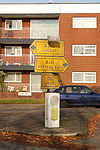
We continue on the A110 past World's End, on the fringe of the urban area. Shortly after, we pass Oakwood Underground station, the penultimate station on the Piccadilly Line. Then we reach a very ordinary, but reasonably well kept roundabout with the A111. A right turn here will take you towards Potters Bar and the M25. Until early 2010 the entire junction was signed in pre-Worboys report signage, last used in this country in the 1960s. There are very few surviving examples of these signs, but at this roundabout we had perhaps the best collection of preserved signs in Britain. Sadly all the signs now seem to have been replaced.
From here, we dog-leg through New Barnet, arriving on the A1000 (former A1) near Underhill. Just to the north of the terminus of the A110 is the eastern end of the A411, which forms a natural continuation westwards.


