Star.pngStar.pngStar grey.pngStar grey.pngStar grey.png

A102(M) Blackwall Tunnel Southern Approach

From Roader's Digest: The SABRE Wiki
Jump to navigation Jump to search
A102(M)
Location Map ( geo)
Cameraicon.png View gallery (8)
Blackwall Tunnel Southern Approach
From:  Blackwall Tunnels (TQ394790)
To:  Kidbrooke Park (TQ408767)
Distance:  2 miles (3.2 km)
Met:  A102, A206, A2052, A207, A2
Now part of:  A102
Traditional Counties

Kent

Route outline (key)
A102(M) Blackwall Tunnel Southern Approach
A102(M) Sun in the Sands - Kidbrooke
Junction List
Junc Northbound Southbound
- A102, A2052, A2203 Start of Road
- A206 A206
- Start of Road A2, A207
- Start of Road A2(M), A20, SXR
This article is about The Blackwall Tunnel Southern Approach.
For The East Cross Route, now A12, see A102(M) East Cross Route
.
Globe.png
For detailed information about this topic, see Pathetic Motorways

The Blackwall Tunnel Southern Approach connected the Blackwall Tunnel to A2 and was part of the eastern side of the proposed Ringway 1 in London.

Route

The A102 (former A102(M)) heading away from the river

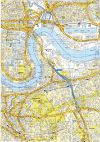
The Blackwall Tunnel Southern Approach headed south from the Blackwall Tunnels at Blackwall Lane Interchange along the Greenwich Peninsula, to Sun in the Sands Roundabout at Shooters Hill Road in Kidbrooke, where it met the A2.

History

Shown by OS as a motorway in 1970 but was it?

The 1.8 mile section was opened on 25 April 1969 by Richard Marsh, Minister of Transport. It was the first stretch of road to be built to motorway standards by the Greater London Council and had dual three lane carriageways, 33 foot wide. This wording in the Middlesex County Times seems to indicate that it was not a motorway from the outset and the appropriation notices for the highway to become a Special Road were published in December 1970. It became a Special Road and A102(M) on 3 March 1972 per the Gazette notice. It was downgraded back to A102 about 2000 (although the Gazette notice has not been seen).

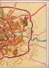
Both sections of A102(M) were intended to form parts of the eastern side of Ringway 1 in London, though in actuality they formed almost all that was ever built. Despite some maps showing the full route from Hackney Wick to Kidbrooke as motorway, including the river crossing itself, neither the tunnels themselves nor the northern approach road were ever part of the motorway. The two sections were linked by a section of primary A102, built to a similar standard but which has footpaths, bus stops and local road accesses along its length.


Links

Roads.org.uk

Pathetic Motorways


A102(M) Blackwall Tunnel Southern Approach
Junctions
Roads
Related Pictures
View gallery (8)
A102(M) 1995 - Coppermine - 163.jpgOld Map London - 1967 - Coppermine - 394.jpgSouthbound A102, East Greenwich (C) David Dixon - Geograph - 3633655.jpgA102(M) at Blackheath (C) Malc McDonald - Geograph - 3302677.jpgNorthward over A102 to Blackwall Tunnel from by Westcombe Park station, Greenwich 1971 - Geograph - 4891027.jpg
Other nearby roads
Blackwall Tunnel
Greenwich
NCN1 • NCN21 • A2 • A102 • A200 • A206 • A207 • A2052 • A2203 • A2211 • B208 • B209 • B210 • B211 • B212 • East Cross Route • EuroVelo 2 • EuroVelo 5 • NCN4
Motorways in Great Britain
Current MotorwaysM1 • M2 • M3 • M4 • M5 • M6 • M6 Toll • M8 • M9 • M11 • M18 • M20 • M23 • M25 • M26 • M27 • M32 • M40 • M42 • M45 • M48 • M49 • M50 • M53 • M54 • M55 • M56 • M57 • M58 • M60 • M61 • M62 • M65 • M66 • M67 • M69 • M73 • M74 • M77 • M80 • M90 • M180 • M181 • M271 • M275 • M602 • M606 • M621 • M876 • M898
A1(M) • A3(M) • A8(M) • A14(M) • A38(M) • A48(M) • A57(M) • A58(M) • A64(M) • A66(M) • A74(M) • A92(M) • A167(M) • A168(M) • A194(M) • A195(M) • A308(M) • A329(M) • A404(M) • A601(M) • A627(M) • A635(M) • A666(M) • A823(M) • A1058(M) • A1077(M)
Motorway Spurs • (M4 Heathrow Spur • M25 T5 Spur • Walton Summit M'way)
Former MotorwaysM10 • M15 • M16 • M30 • M41 • M52 • M62 • M63 • M64 • M65 • M68 • M85 • M110 • M111 • M270 • M274 • M531 • M600
A2(M) • A4(M) • A5(M) • A8(M) • A11(M) • A18(M) • A20(M) • A21(M) • A23(M) • A36(M) • A40(M) (Central London) • A40(M) (Buckinghamshire) • A41(M) • A46(M) • A48(M) (Morriston) • A48(M) (Port Talbot) • A65(M) • A102(M) (North) • A102(M) (South) • A423(M) • A446(M) • A604(M) • A638(M) • A696(M) • A1231(M) • A6127(M) • A6138(M) • A6144(M)
Unbuilt MotorwaysM4 Toll • M12 (Woodford - Brentford) • M12 (Woodford - Maplin) • M12 (Brentwood - -Chelmsford) • M13 • M17 • M19 • M31 • M58 • M59 • M60 • M62 RR • M64 • M81 • M82 • M83 • M100 • M272 • M601 • M650
A2(M) • A6(M) (West) • A6(M) (East) • A14(M) • A48(M) • A59(M) • A61(M) • A556(M) • A695(M)
A Ring • Bilston Link • Belmont Link • B-W M'way • CME Bypass • CMW • Central Spine • Chippenham Spur • Coventry N-S M'way • Cublington Airport M'way • Denham Spur • Derby Urban M'way • Droitwich-Leicester M'way • East Coast M'way • EXR • East Kilbride M'way • E-W Underground M'way • Eastern M'way • Euroroute • Friars Goose Xing • Furness Link • Glasgow IRR • GM Western Relief Road • Hamilton-Cumbernauld M'way • Hook Road • Johnstone M'way • Kendal Link • Liverpool Inner M'way • LOX M'way • Malvern Radial • Manchester IRR • Morecambe Link • NE Urban M'way • NXR • N&W M'way • Paisley-Hamilton M'way • POLO • Princess P'way M'way • Reading Urban M'way • Ringway 2 • Sheffield Spur • S Bristol Spur • SCRPDR • SXR • Stirling Corner Link • Strensham-Solihill M'way • Strensham-Solihill M'way • TGAAR • Townhill Link • Trafford Park M'way • Warndon Radial • Watford Urban M'Way • Western Orbital • Weston Spur


SABRE - The Society for All British and Irish Road Enthusiasts
Discuss - Digest - Discover - Help